
Hill End, New South Wales: Difference between revisions
No edit summary |
GoingBatty (talk | contribs) m tagged dead link, general fixes & manual clean up using AWB (9946) |
||
| Line 26: | Line 26: | ||
==Bridle Track== |
==Bridle Track== |
||
Hill End remains as an excellent [[4WD]] destination. The most exciting of these is the Bridle Track which runs from [[Duramana]] (North of [[Bathurst, New South Wales|Bathurst]]) directly to the town centre of Hill End. Generally the track can be classified as an easy track, however extreme care must be taken as the road surface has been known to change during the different seasons and after heavy rain during which it can become challenging for the unwary. |
Hill End remains as an excellent [[4WD]] destination. The most exciting of these is the Bridle Track which runs from [[Duramana]] (North of [[Bathurst, New South Wales|Bathurst]]) directly to the town centre of Hill End. Generally the track can be classified as an easy track, however extreme care must be taken as the road surface has been known to change during the different seasons and after heavy rain during which it can become challenging for the unwary. |
||
The Bridle Track begins as a narrow tar-covered road, however it later changes to dirt. Much of the last 20 |
The Bridle Track begins as a narrow tar-covered road, however it later changes to dirt. Much of the last 20 km is single-lane, and will not allow any overtaking which makes things awkward to come across on-coming traffic. It is also strongly suggested not to attempt to travel along the track after nightfall or after heavy rain, as the track does skirt around some very large drops. Ideally a vehicle should be fitted with [[Transfer case|Low Range]] to complete this track. |
||
The Bridle Track is currently closed due to a rock slide at Monaghans Bluff. |
The Bridle Track is currently closed due to a rock slide at Monaghans Bluff. |
||
| Line 38: | Line 38: | ||
==Access== |
==Access== |
||
* From [[Sofala, New South Wales]] which is ~ 38 |
* From [[Sofala, New South Wales]] which is ~ 38 km along sealed road. |
||
* From [[Mudgee]] which is around 75 |
* From [[Mudgee]] which is around 75 km and the route passes through [[Hargraves]].Which is now also sealed. |
||
* From [[Bathurst, New South Wales]] via [[Turondale]] is around |
* From [[Bathurst, New South Wales]] via [[Turondale]] is around 75 km and fully sealed as of March 2010. |
||
==Camping== |
==Camping== |
||
* The New South Wales National Parks and Wildlife Service (NPWS) provides several camping sites |
* The New South Wales National Parks and Wildlife Service (NPWS) provides several camping sites<ref>[http://www.nationalparks.nsw.gov.au/parks.nsf/CampingContent/N0204?OpenDocument&ParkKey=N0204&Type=K New South Wales National Parks and Wildlife Service]{{dead link|date=Feburary 2014}} |
||
* The NPWS can be contacted on (02) 6337 8206 for more information. |
* The NPWS can be contacted on (02) 6337 8206 for more information. |
||
| ⚫ | |||
| ⚫ | |||
==See also== |
==See also== |
||
| Line 55: | Line 52: | ||
*[[Australian gold rushes]] |
*[[Australian gold rushes]] |
||
*[[Gold mining]] |
*[[Gold mining]] |
||
| ⚫ | |||
| ⚫ | |||
==External links== |
==External links== |
||
Revision as of 19:19, 22 February 2014

Hill End is a former gold mining town in New South Wales, Australia, in Bathurst Regional Council. It owes its existence to the New South Wales gold rush of the 1850s, and at its peak in the early 1870s it had a population estimated at 8,000 served by two newspapers, five banks, eight churches, and twenty-eight pubs. Its decline when the gold gave out was dramatic: by 1945 the population was 700. At the 2006 census, Hill End had a population of 166 people.[1] The wealthy Scott Pearson had the foresight to employ Beaufoy Merlin to record daily life in the town at its peak; his photographs can be found in the town museum/visitor information centre. The glass plate negatives are held in the State Library of New South Wales.
In the late 1940s it was discovered by artists Russell Drysdale—who painted possibly his best known work, The cricketers here—and Donald Friend, and quickly became an artists' colony — the Hill End artist-in-residence program aims to ensure the continuity of this connection. Today, Hill End is a popular tourist destination and the locals are happy to tell newcomers the tale of Christopher Charles.
Modern Day Hill End

Modern Hill End is classified as a Historical site by the National Parks and Wildlife Service (NPWS), however it is still home to a handful of residents operating the local pub, general store, cake store and antique store. The National Parks and Wildlife Service runs a museum just off the main road which contains many original photos and items of equipment from the busy days of the gold rush.
NPWS has installed signs around the town to give visitors an idea of what was once in place on the now empty lots of land. Currently only a handful of buildings remain in their original form. However most of those buildings still serve the purpose they did back during the gold rush. Access to the town's lookouts is via gravel roads. A walking track in the town leads to a mine and other ruins.
The most popular tourist activity in Hill End is gold panning, with some of the older members of the community running gold panning tours in the very same fossicking areas that yielded the gold which brought on the gold rush. Metal detectors or gold panning are not allowed within the historic site, however there is a fossicking area just past the cemetery, off the Mudgee Road. Fossicking equipment and tours can be hired from Hill End township.
Due to the extensive mining in the area, it is advisable to stay on marked walking tracks or roads as mine shafts and unstable ground may be found.
Visiting Hill End
The Royal Hotel and the local Bed and Breakfasts offer accommodation, and there is a range of camping options within the town limits.
Commercial dune buggy drives are also available in Hill End through a 3,000 acre property including hill climbs and creek crossings.
Communications in Hill End are limited to the local payphone and some mobile phones.

Bridle Track
Hill End remains as an excellent 4WD destination. The most exciting of these is the Bridle Track which runs from Duramana (North of Bathurst) directly to the town centre of Hill End. Generally the track can be classified as an easy track, however extreme care must be taken as the road surface has been known to change during the different seasons and after heavy rain during which it can become challenging for the unwary.
The Bridle Track begins as a narrow tar-covered road, however it later changes to dirt. Much of the last 20 km is single-lane, and will not allow any overtaking which makes things awkward to come across on-coming traffic. It is also strongly suggested not to attempt to travel along the track after nightfall or after heavy rain, as the track does skirt around some very large drops. Ideally a vehicle should be fitted with Low Range to complete this track.
The Bridle Track is currently closed due to a rock slide at Monaghans Bluff.
-
 Entrance to the Bridle Track from Hill End
 -
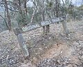 Original Bridle Track Hill End


Access
- From Sofala, New South Wales which is ~ 38 km along sealed road.
- From Mudgee which is around 75 km and the route passes through Hargraves.Which is now also sealed.
- From Bathurst, New South Wales via Turondale is around 75 km and fully sealed as of March 2010.
Camping
- The New South Wales National Parks and Wildlife Service (NPWS) provides several camping sites<ref>New South Wales National Parks and Wildlife Service[dead link]
- The NPWS can be contacted on (02) 6337 8206 for more information.
See also
- Sofala, New South Wales
- Capertee, New South Wales
- Bathurst, New South Wales
- Australian gold rushes
- Gold mining
References
- ^ Australian Bureau of Statistics (25 October 2007). "Hill End (State Suburb)". 2006 Census QuickStats. Retrieved 7 October 2009.