
Gambia River: Difference between revisions
ce |
Gambia River Tag: repeated addition of external links by non-autoconfirmed user |
||
| Line 27: | Line 27: | ||
| subdivision_name5 = |
| subdivision_name5 = |
||
<!---------------------- PHYSICAL CHARACTERISTICS --> |
<!---------------------- PHYSICAL CHARACTERISTICS --> |
||
| length = {{convert|1120<ref>{{cite encyclopedia |title=Gambia River |encyclopedia=[[Encyclopædia Britannica]] |url=https://global.britannica.com/place/Gambia-River |access-date=30 October 2016}}</ref>|km|mi|abbr=on}} |
| length = {{convert|1120<ref>{{cite encyclopedia |title=[https://treeinhindi.kshitijsays.com/2020/06/gulmohar-tree-information-use.htmlr Gambia River] |encyclopedia=[[Encyclopædia Britannica]] |url=https://global.britannica.com/place/Gambia-River |access-date=30 October 2016}}</ref>|km|mi|abbr=on}} |
||
| width_min = |
| width_min = |
||
| width_avg = |
| width_avg = |
||
Revision as of 14:16, 4 June 2020
| Gambia River | |
|---|---|
 Gambia River in the Niokolo-Koba National Park | |
 Map of the Gambia River drainage basin | |
| Location | |
| Country | Guinea, Senegal, The Gambia |
| Physical characteristics | |
| Source | Fouta Djallon |
| Mouth | Atlantic Ocean |
• location | Banjul |
• coordinates | 13°28′N 16°34′W / 13.467°N 16.567°W |
| Length | 1,120[1] km (700 mi) |
The Gambia River (formerly known as the River Gambra) is a major river in West Africa, running 1,120 kilometres (700 mi) from the Fouta Djallon plateau in north Guinea westward through Senegal and The Gambia to the Atlantic Ocean at the city of Banjul. It is navigable for about half that length.
The river is strongly associated with The Gambia, the smallest country in mainland Africa, which consists of little more than the downstream half of the river and its two banks.
From the Fouta Djallon, the river runs northwest into the Tambacounda Region of Senegal, where it flows through the Parc National du Niokolo Koba, then is joined by the Nieri Ko and Koulountou before entering the Gambia at Fatoto. At this point, the river runs generally west, but in a meandering course with a number of oxbows, and about 100km from its mouth it gradually widens, to over 10km wide where it meets the sea.
Near the mouth of the river, near Juffure, is Kunta Kinteh Island, a place used in the slave trade which is now a UNESCO World Heritage Site.
The aquatic fauna in the Gambia River basin is closely associated with that of the Senegal River basin, and the two are usually combined under a single ecoregion known as the Senegal-Gambia Catchments. Although the species richness is moderately high, only three species of frogs and one fish are endemic to this ecoregion.[2]
Oysters are harvested from the River Gambia by women and used to make oyster stew, a traditional dish in the cuisine of Gambia.
-
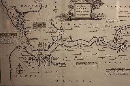 Map of the River Gambra (now the Gambia) 1732
 -
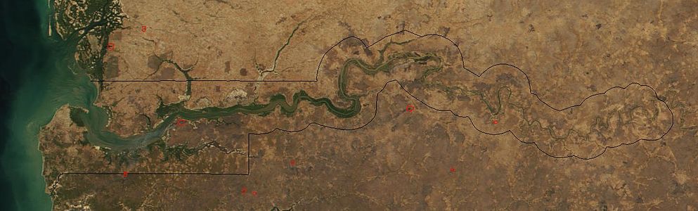 The western portion of the Gambia River, seen from space. The line shows the border of The Gambia.
_1732.JPG)

References
- ^ "[https://treeinhindi.kshitijsays.com/2020/06/gulmohar-tree-information-use.htmlr Gambia River]". Encyclopædia Britannica. Retrieved 30 October 2016.
{{cite encyclopedia}}: External link in|title= - ^ "509: Senegal – Gambia". Freshwater Ecoregions of the World. Archived from the original on 30 October 2016. Retrieved 30 October 2016.
External links
 Media related to Gambia River at Wikimedia Commons
- Gambia River Information & Photos
| International | |
|---|---|
| National | |