
Four Shire Stone: Difference between revisions
m →Boundary marker: rly stn at Moreton |
rm infobox that merely takes up space without providing any useful information; add map showing the quadripoint in more detail |
||
| Line 1: | Line 1: | ||
{{Short description|Boundary marker in Gloucestershire, Oxfordshire and Warwickshire, UK}} |
{{Short description|Boundary marker in Gloucestershire, Oxfordshire and Warwickshire, UK}} |
||
{{Use dmy dates|date=April 2022}} |
{{Use dmy dates|date=April 2022}} |
||
| ⚫ | |||
{{Infobox monument |
|||
| ⚫ | The '''Four Shire Stone''' is a [[boundary marker]] that marks the point where the [[historic counties of England|English counties]] of [[Warwickshire]], [[Oxfordshire]], [[Gloucestershire]], and [[Worcestershire]] once met. Since 1931, when the Worcestershire exclave of [[Evenlode]] was transferred to Gloucestershire, only three counties have met at the stone.<ref>{{cite web |title=The Four Shire Stone Moreton-in-Marsh |url=http://www.hunimex.com/warwick/four_shire_stone.html |access-date=12 August 2013}}</ref> |
||
| name = Four Shire Stone |
|||
| ⚫ | |||
| caption = The Four Shire Stone at the meeting point of [[Warwickshire]], [[Oxfordshire]], [[Gloucestershire]], and formerly also [[Worcestershire]] |
|||
| material = Stonework |
|||
| height = 9 feet |
|||
| coordinates = {{coord|51|59|14.96|N|1|39|56.65|W|}} |
|||
}} |
|||
| ⚫ | The '''Four Shire Stone''' is a [[boundary marker]] that marks the |
||
==Boundary marker== |
==Boundary marker== |
||
| ⚫ | [[File:Four-County-Stone-Hollar-1660.png|thumb|Detail from Wenceslaus Hollar's ''An Orthographical Designe of Several Views Upon Ye Road, in England and Wales'' (1660)<ref>{{Citation |author=British Library |title=The BL King's Topographical Collection: "An Orthographical Designe of Several Views Upon Ye Road, in England and Wales" |date=24 August 2020 |url=https://www.flickr.com/photos/britishlibrary/50263236958/ |access-date=7 March 2021}}</ref>]] |
||
[[File:Shire Stones.png|thumb|Detail from [[Joan Blaeu]]'s map of Gloucestershire (1662), showing the "Shire Stones"]] |
|||
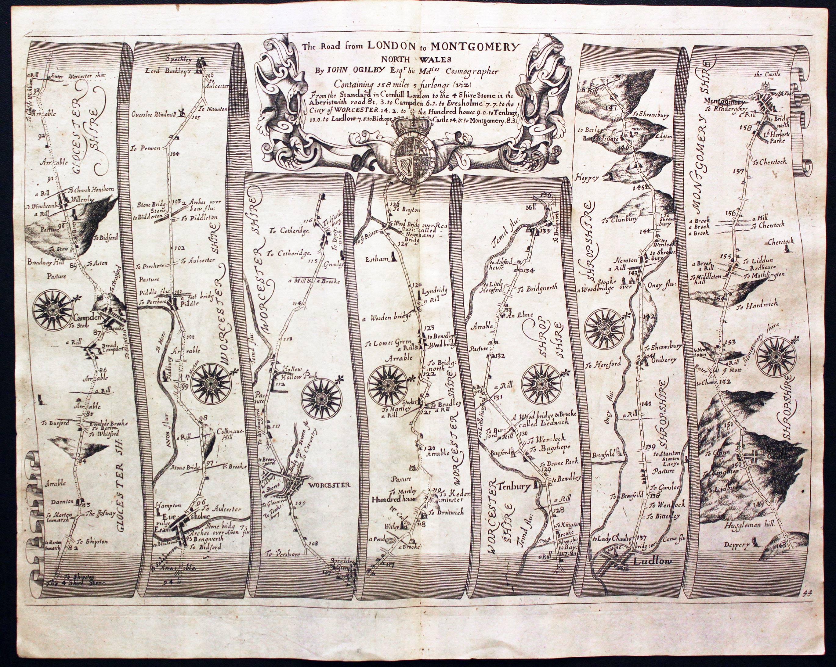
The Four Shire Stone is not a single stone, but a nine-foot high monument, built from the local [[Cotswold stone]]. It is in the [[English midlands]] at the northern corner of a [[T junction]] on the [[A44 road (Great Britain)|A44 road]], a mile and a half east of the small town of [[Moreton-in-Marsh]] (which has the closest railway station), at {{coord|51|59|15|N|1|39|57|W|display=inline,title|name=Four Shire Stone}}, grid reference SP2301432023. The existing structure was probably built in the 18th century, and is a grade II [[listed building]].<ref>{{cite web |title=Four Shire Stone, British Listed Buildings |url=https://www.britishlistedbuildings.co.uk/101303562-the-four-shire-stone-little-compton |access-date=8 May 2018}}</ref> There was an earlier "4 Shire Stone" on or near the site in 1675, almost certainly that illustrated in 1660.<ref>{{cite book |author=Ogilby, John | title=Britannia Atlas |year=1675 |location=Richard Nicholson of Chester, map dealer|page=Plate 44 |url=http://www.antiquemaps.com/uk/mzoom/29411.jpg |access-date=1 October 2013 | author-link=John Ogilby}}</ref><ref>{{Citation|last=Library|first=British|title=The BL King's Topographical Collection: "An Orthographical Designe of Several Views Upon Ye Road, in England and Wales. "|date=2020-08-24|url=https://www.flickr.com/photos/britishlibrary/50263236958/|access-date=2021-03-07}}</ref> [[Thomas Habington]]'s ''Survey of Worcestershire'' mentions "the stone which toucheth four sheeres, a thing rarely scene".<ref>{{cite book |last1=Abingdon |first1=Thomas |editor-last1=Amphlett |editor-first1=John |title=A survey of Worcestershire |chapter-url=https://archive.org/stream/surveyofworceste02abinuoft#page/68 |volume=2 Pt.2 |year=1897 |publisher=James Parker for the Worcestershire Historical Society |location=Oxford|page=68 |chapter=Evenlode}}</ref> |
The Four Shire Stone is not a single stone, but a nine-foot high monument, built from the local [[Cotswold stone]]. It is in the [[English midlands]] at the northern corner of a [[T junction]] on the [[A44 road (Great Britain)|A44 road]], a mile and a half east of the small town of [[Moreton-in-Marsh]] (which has the closest railway station), at {{coord|51|59|15|N|1|39|57|W|display=inline,title|name=Four Shire Stone}}, grid reference SP2301432023. The existing structure was probably built in the 18th century, and is a grade II [[listed building]].<ref>{{cite web |title=Four Shire Stone, British Listed Buildings |url=https://www.britishlistedbuildings.co.uk/101303562-the-four-shire-stone-little-compton |access-date=8 May 2018}}</ref> There was an earlier "4 Shire Stone" on or near the site in 1675, almost certainly that illustrated in 1660.<ref>{{cite book |author=Ogilby, John | title=Britannia Atlas |year=1675 |location=Richard Nicholson of Chester, map dealer|page=Plate 44 |url=http://www.antiquemaps.com/uk/mzoom/29411.jpg |access-date=1 October 2013 | author-link=John Ogilby}}</ref><ref>{{Citation|last=Library|first=British|title=The BL King's Topographical Collection: "An Orthographical Designe of Several Views Upon Ye Road, in England and Wales. "|date=2020-08-24|url=https://www.flickr.com/photos/britishlibrary/50263236958/|access-date=2021-03-07}}</ref> [[Thomas Habington]]'s ''Survey of Worcestershire'' mentions "the stone which toucheth four sheeres, a thing rarely scene".<ref>{{cite book |last1=Abingdon |first1=Thomas |editor-last1=Amphlett |editor-first1=John |title=A survey of Worcestershire |chapter-url=https://archive.org/stream/surveyofworceste02abinuoft#page/68 |volume=2 Pt.2 |year=1897 |publisher=James Parker for the Worcestershire Historical Society |location=Oxford|page=68 |chapter=Evenlode}}</ref> |
||
| Line 24: | Line 17: | ||
* [[Chastleton]] to the southeast, in Oxfordshire; |
* [[Chastleton]] to the southeast, in Oxfordshire; |
||
* [[Evenlode (parish)|Evenlode]] to the south, now also in Gloucestershire; [[Evolution of Worcestershire county boundaries since 1844#Provisional Order Confirmation (Gloucestershire, Warwickshire and Worcestershire) Act 1931|until 1931]] it was a [[detached part]] of Worcestershire. |
* [[Evenlode (parish)|Evenlode]] to the south, now also in Gloucestershire; [[Evolution of Worcestershire county boundaries since 1844#Provisional Order Confirmation (Gloucestershire, Warwickshire and Worcestershire) Act 1931|until 1931]] it was a [[detached part]] of Worcestershire. |
||
Most of Worcestershire is to the north-west of the stone. Thus the order of the four counties around the stone was different from what one might expect from a map of England. The stone ceased to be the meeting-point of four shires in 1931, when Evenlode was transferred to Gloucestershire, so since that date only three counties meet at the stone.<ref>{{cite web |title=The Four Shire Stone Moreton-in-Marsh |url=http://www.hunimex.com/warwick/four_shire_stone.html |access-date=12 August 2013}}</ref> |
|||
The J. R. R. Tolkien Society claims that the Four Shire Stone inspired the "Three-Farthing Stone" in [[J. R. R. Tolkien]]'s book ''[[The Lord of the Rings]]''. In that work, [[Shire (Middle-earth)|the Shire]], the homeland of the [[hobbits]] is divided into four farthings, three of which meet at the "Three-Farthing Stone".<ref>{{cite web |title=Moreton-in-Marsh Tourist Information and Travel Guide |url=http://www.cotswolds.info/places/moreton-in-marsh.shtml |publisher=cotswolds.info |access-date=12 August 2013}}</ref><ref>{{cite book |last=Hooker |first=Mark T. |date=2009 |title=The Hobbitonian Anthology |publisher=Llyfrawr |pages=98–99 |isbn=978-1448617012}}</ref> |
The J. R. R. Tolkien Society claims that the Four Shire Stone inspired the "Three-Farthing Stone" in [[J. R. R. Tolkien]]'s book ''[[The Lord of the Rings]]''. In that work, [[Shire (Middle-earth)|the Shire]], the homeland of the [[hobbits]] is divided into four farthings, three of which meet at the "Three-Farthing Stone".<ref>{{cite web |title=Moreton-in-Marsh Tourist Information and Travel Guide |url=http://www.cotswolds.info/places/moreton-in-marsh.shtml |publisher=cotswolds.info |access-date=12 August 2013}}</ref><ref>{{cite book |last=Hooker |first=Mark T. |date=2009 |title=The Hobbitonian Anthology |publisher=Llyfrawr |pages=98–99 |isbn=978-1448617012}}</ref> |
||
<gallery mode="packed" heights="200px"> |
|||
| ⚫ | File:Four-County-Stone-Hollar-1660.png|Detail from Wenceslaus Hollar |
||
File:Four-shire-stone-map.png|Detail of map from ''Philips' New handy general Atlas'', 1921, showing four counties meeting at the Four Shire Stone. Worcestershire is shown in yellow, Warwickshire in green, Oxfordshire in violet{{efn|Because of an error in the printing, the salient of Oxfordshire that extends to the stone appears in mauve rather than the violet of the rest of Oxfordshire.}} and Gloucestershire in pink. |
|||
</gallery> |
|||
== 2022 restoration == |
== 2022 restoration == |
||
The failing state of this unique bit of local history inspired James Hayman-Joyce, a local, semi-retired chartered surveyor, to do what he could to restore it. He formed the Four Shire Stone Restoration Committee with the aim of raising £20,000 to restore the Four Shire Stone to its former glory. The project comprises restoring and repairing the stonework, replacing the railings and enhancing the engravings on all four sides of the pillar.<ref>{{cite web |title=Four Shire Stone Restoration Project |url=https://www.fourshirestone.org.uk |access-date=6 April 2022}}</ref> |
The failing state of this unique bit of local history inspired James Hayman-Joyce, a local, semi-retired chartered surveyor, to do what he could to restore it. He formed the Four Shire Stone Restoration Committee with the aim of raising £20,000 to restore the Four Shire Stone to its former glory. The project comprises restoring and repairing the stonework, replacing the railings and enhancing the engravings on all four sides of the pillar.<ref>{{cite web |title=Four Shire Stone Restoration Project |url=https://www.fourshirestone.org.uk |access-date=6 April 2022}}</ref> |
||
== See also == |
== See also == |
||
* [[Quadripoint]] |
* [[Quadripoint]] |
||
* [[Three Shires Oak]], marking the meeting point of Derbyshire, Nottinghamshire and Yorkshire |
* [[Three Shires Oak]], marking the meeting point of Derbyshire, Nottinghamshire and Yorkshire |
||
* [[No Man's Heath, Warwickshire]], meeting point of Leicestershire, Warwickshire, and Staffordshire |
* [[No Man's Heath, Warwickshire]], meeting point of Leicestershire, Warwickshire, and Staffordshire |
||
* [[Dow Bridge]], meeting point of Warwickshire, Northamptonshire and Leicestershire |
* [[Dow Bridge]], meeting point of Warwickshire, Northamptonshire and Leicestershire |
||
== Notes == |
|||
{{notelist}} |
|||
== References == |
== References == |
||
{{reflist}} |
{{reflist}} |
||
Latest revision as of 14:23, 16 June 2024

The Four Shire Stone is a boundary marker that marks the point where the English counties of Warwickshire, Oxfordshire, Gloucestershire, and Worcestershire once met. Since 1931, when the Worcestershire exclave of Evenlode was transferred to Gloucestershire, only three counties have met at the stone.[1]
Boundary marker
[edit]

The Four Shire Stone is not a single stone, but a nine-foot high monument, built from the local Cotswold stone. It is in the English midlands at the northern corner of a T junction on the A44 road, a mile and a half east of the small town of Moreton-in-Marsh (which has the closest railway station), at 51°59′15″N 1°39′57″W / 51.98750°N 1.66583°W, grid reference SP2301432023. The existing structure was probably built in the 18th century, and is a grade II listed building.[3] There was an earlier "4 Shire Stone" on or near the site in 1675, almost certainly that illustrated in 1660.[4][5] Thomas Habington's Survey of Worcestershire mentions "the stone which toucheth four sheeres, a thing rarely scene".[6]
Five (formerly seven) civil parishes meet at the stone:[7]
- Moreton-in-Marsh to the west, in Gloucestershire;
- Formerly Batsford to the northwest, also in Gloucestershire, until Batsford/Moreton-in-Marsh boundary change in 1987;[8]
- Formerly Lower Lemington to the north, also in Gloucestershire, and which merged into Batsford in 1935;[9]
- Great Wolford to the north, in Warwickshire;
- Little Compton to the northeast, also in Warwickshire;
- Chastleton to the southeast, in Oxfordshire;
- Evenlode to the south, now also in Gloucestershire; until 1931 it was a detached part of Worcestershire.
The J. R. R. Tolkien Society claims that the Four Shire Stone inspired the "Three-Farthing Stone" in J. R. R. Tolkien's book The Lord of the Rings. In that work, the Shire, the homeland of the hobbits is divided into four farthings, three of which meet at the "Three-Farthing Stone".[10][11]
2022 restoration
[edit]The failing state of this unique bit of local history inspired James Hayman-Joyce, a local, semi-retired chartered surveyor, to do what he could to restore it. He formed the Four Shire Stone Restoration Committee with the aim of raising £20,000 to restore the Four Shire Stone to its former glory. The project comprises restoring and repairing the stonework, replacing the railings and enhancing the engravings on all four sides of the pillar.[12]
See also
[edit]- Quadripoint
- Three Shires Oak, marking the meeting point of Derbyshire, Nottinghamshire and Yorkshire
- No Man's Heath, Warwickshire, meeting point of Leicestershire, Warwickshire, and Staffordshire
- Dow Bridge, meeting point of Warwickshire, Northamptonshire and Leicestershire
References
[edit]- ^ "The Four Shire Stone Moreton-in-Marsh". Retrieved 12 August 2013.
- ^ British Library (24 August 2020), The BL King's Topographical Collection: "An Orthographical Designe of Several Views Upon Ye Road, in England and Wales", retrieved 7 March 2021
- ^ "Four Shire Stone, British Listed Buildings". Retrieved 8 May 2018.
- ^ Ogilby, John (1675). Britannia Atlas. Richard Nicholson of Chester, map dealer. p. Plate 44. Retrieved 1 October 2013.
- ^ Library, British (24 August 2020), The BL King's Topographical Collection: "An Orthographical Designe of Several Views Upon Ye Road, in England and Wales. ", retrieved 7 March 2021
- ^ Abingdon, Thomas (1897). "Evenlode". In Amphlett, John (ed.). A survey of Worcestershire. Vol. 2 Pt.2. Oxford: James Parker for the Worcestershire Historical Society. p. 68.
- ^ "Gloucestershire". Ordnance Survey Miscellaneous Boundary Maps. Vision of Britain. 1967. Retrieved 3 May 2018.; "Oxfordshire". Ordnance Survey Miscellaneous Boundary Maps. Vision of Britain. 1966. Retrieved 3 May 2018.; "Warwickshire". Ordnance Survey Maps of England and Wales. Vision of Britain. 1900. Retrieved 3 May 2018.
- ^ "The Cotswold (Parishes) Order 1986" (PDF).
- ^ "Gloucestershire". Ordnance Survey Sanitary Districts, showing Civil Parishes. Vision of Britain. 1888. Retrieved 3 May 2018.; Elrington, C. R., ed. (1965). "Parishes: Lower Lemington". Gloucester. Victoria County History. Vol. 6. London: British History Online. pp. 216–220. Retrieved 4 May 2018.
- ^ "Moreton-in-Marsh Tourist Information and Travel Guide". cotswolds.info. Retrieved 12 August 2013.
- ^ Hooker, Mark T. (2009). The Hobbitonian Anthology. Llyfrawr. pp. 98–99. ISBN 978-1448617012.
- ^ "Four Shire Stone Restoration Project". Retrieved 6 April 2022.
External links
[edit]- Boundary markers
- Quadripoints and higher
- Cotswold District
- West Oxfordshire District
- Stratford-on-Avon District
- History of Worcestershire
- Monuments and memorials in Gloucestershire
- Grade II listed buildings in Gloucestershire
- Monuments and memorials in Oxfordshire
- Grade II listed buildings in Oxfordshire
- Monuments and memorials in Warwickshire
- Grade II listed buildings in Warwickshire
- 18th-century architecture in the United Kingdom
- Monumental columns in the United Kingdom
- Moreton-in-Marsh
- Geography of Warwickshire
- Geography of Oxfordshire
- Geography of Gloucestershire
- Geography of Worcestershire