Troelstralaan metro station: Difference between revisions
Appearance
Content deleted Content added
→top: add decade category |
Entranced98 (talk | contribs) Importing Wikidata short description: "Metro station in Schiedam, Netherlands" |
||
| Line 1: | Line 1: | ||
{{Short description|Metro station in Schiedam, Netherlands}} |
|||
{{Infobox station |
{{Infobox station |
||
| name = Troelstralaan |
| name = Troelstralaan |
||
Revision as of 13:44, 8 July 2024
| Rotterdam Metro station | |||||||||||
 | |||||||||||
| General information | |||||||||||
| Coordinates | 51°54′55″N 4°23′03″E / 51.91528°N 4.38417°E | ||||||||||
| Owned by | RET | ||||||||||
| Platforms | Island platform | ||||||||||
| Tracks | 2 | ||||||||||
| Construction | |||||||||||
| Structure type | At-grade | ||||||||||
| History | |||||||||||
| Opened | 2002 | ||||||||||
| Services | |||||||||||
| |||||||||||
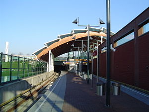
Troelstralaan is a metro station in Schiedam, situated on Rotterdam Metro line C. The station was opened on 4 November 2002 as part of the last major expansion of the Rotterdam metro. The main entrance, at the east end of the subway station, is located on the street named after P.J. Troelstra, and the island platform is accessible by entrances on both ends.
