
Lava Tree State Monument: Difference between revisions
Content deleted Content added
→GALLERY: Added the following text: The following photos were taken along the foot path of the park. |
→External Links: Repaired broken link to USGS website. and added link to State of Hawaii, Dept. of Land and Natural Resources |
||
| Line 35: | Line 35: | ||
==External links== |
==External links== |
||
*[http://volcanoes.usgs.gov/ |
*[http://volcanoes.usgs.gov/images/pglossary/treemold.php USGS Photo Glossary page] |
||
*[http://www.hawaiistateparks.org/parks/hawaii/index.cfm?park_id=51 State of Hawaii, Dept. of Land and Natural Resources] |
|||
*[http://www.hawaiiweb.com/hawaii/html/sites/lawa_tree_state_park.html Hawaiiweb.com] |
*[http://www.hawaiiweb.com/hawaii/html/sites/lawa_tree_state_park.html Hawaiiweb.com] |
||
Revision as of 15:34, 14 August 2009

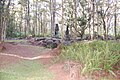
Lava Tree State Monument is located 2.7 miles southeast of Pahoa in the Puna District on big island of Hawaii. It preserves lava molds of the tree trunks that were formed when a lava flow swept through a forested area in 1790.
GALLERY
- The following photos were taken along the foot path of the park.
-
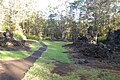 Path
Path -
 Path
Path -
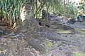 Lava Trees
 -
 Shelter
 -
 Lava Trees
 -
 Lava Trees
 -
 Lava Trees and path
 -
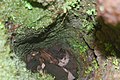
 Inside view of lava tree
 -
 Inside view of lava tree with moss
 -
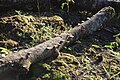
 Large lava tree that fell and broke apart
 -
 Lava tree
 -
 Interesting lava formation inside one of the lava trees
 -
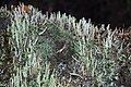
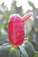 Plant life
 -
 Plant life
 -
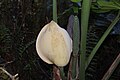
 Orchid growing in the wild
 -
 Fungi with interesting orange crown
 -
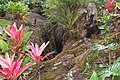 Plant life near deep cut in the ground
 -
 Fungi growing on fallen tree
 -
 Plant life
 -
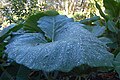 Plant life with morning dew
 -
 Plant life and moss growing inside trunk of lava tree
 -
 Plant life and moss growing inside trunk of lava tree
 -
 Vines growing from tree at park entry


External links
This Hawaiʻi state location article is a stub. You can help Wikipedia by expanding it. |