Coité do Nóia: Difference between revisions
Appearance
Content deleted Content added
removed Category:Populated places in Alagoas; added Category:Municipalities in Alagoas using HotCat |
Rescuing 1 sources and tagging 0 as dead. #IABot (v1.2.7.1) |
||
| Line 38: | Line 38: | ||
|area_metro_km2 = |
|area_metro_km2 = |
||
|area_metro_sq_mi = |
|area_metro_sq_mi = |
||
|population_as_of = 2010.<ref>[[Brazilian Institute of Geography and Statistics|IBGE]] - |
|population_as_of = 2010.<ref>[[Brazilian Institute of Geography and Statistics|IBGE]] - {{cite web|url=http://www.ibge.gov.br/cidadesat/default.php |title=Archived copy |accessdate=2008-06-11 |deadurl=yes |archiveurl=https://web.archive.org/web/20080611095922/http://www.ibge.gov.br/cidadesat/default.php |archivedate=2008-06-11 |df= }}</ref> |
||
|population_note = |
|population_note = |
||
|population_total = 10926 |
|population_total = 10926 |
||
Revision as of 13:47, 27 November 2016
9°37′55″S 36°34′44″W / 9.63194°S 36.57889°W
Coité do Noia | |
|---|---|
Municipality | |
| Country | |
| State | Alagoas |
| Mesoregion | Agreste Alagoano |
| Microregion | Arapiraca |
| Government | |
| • Mayor | Bueno Higino |
| Area | |
| • Total | 88.488 km2 (34.165 sq mi) |
| Population (2010.[1]) | |
| • Total | 10,926 |
| • Density | 120/km2 (320/sq mi) |
| Time zone | UTC-4 (UTC-4) |
| • Summer (DST) | UTC-3 (UTC-3) |
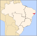
Coité do Noia is a municipality located in the center of the Brazilian state of Alagoas.
References
- ^ IBGE - "Archived copy". Archived from the original on 2008-06-11. Retrieved 2008-06-11.
{{cite web}}: Unknown parameter|deadurl=ignored (|url-status=suggested) (help)CS1 maint: archived copy as title (link)

