Hudun: Difference between revisions
Appearance
Content deleted Content added
Reer Libaax (talk | contribs) Correcting errors and providing accurate sources. |
Reer Libaax (talk | contribs) mNo edit summary |
||
| Line 66: | Line 66: | ||
[[Somaliland]] has full control over this district. The local people from [[Bohol, Somalia |Bohol]] has an army base.<ref>{{cite web|http://www.raxanreeb.com/2014/06/somalia-somaliland-forces-capture-talex-sool-region/</ref> |
[[Somaliland]] has full control over this district. The local people from [[Bohol, Somalia |Bohol]] has an army base.<ref>{{cite web|http://www.raxanreeb.com/2014/06/somalia-somaliland-forces-capture-talex-sool-region/</ref> |
||
==Education== |
==Education== |
||
Revision as of 13:39, 1 August 2017
Xudun | |
|---|---|
Town | |
| Coordinates: 9°6′45″N 47°27′38″E / 9.11250°N 47.46056°E | |
| Country | |
| Region | Sool |
| District | Xudun |
| Time zone | UTC+3 (EAT) |
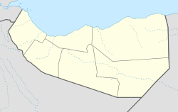
Xudun (Hudun) is a town in the northern Sool region of Somaliland.[1]
Overview
The center of the Xudun District, the settlement lies 59 kilometres north by road from the provincial capital of Las Anod.[2]
Somaliland has full control over this district. The local people from Bohol has an army base.[3]
Education
Xudun has a number of academic institutions. According to the Somaliland Ministry of Education, there are 7 primary schools in the Xudun District. Among these are Xudun Primary, Lafweyne, Holol and Kulaal.[4] Secondary schools in the area include Xudun Secondary.[5]
Notes
- ^ "Districts of Somalia".
- ^ Google Maps (Map). Google.
{{cite map}}:|access-date=requires|url=(help) - ^ {{cite web|http://www.raxanreeb.com/2014/06/somalia-somaliland-forces-capture-talex-sool-region/
- ^ "Puntland - Primary schools". Ministry of Education of Puntland. Retrieved 26 May 2013.
- ^ "Puntland - Secondary schools". Ministry of Education of Puntland. Retrieved 26 May 2013.

