Horufadhi: Difference between revisions
Appearance
Content deleted Content added
Reer Libaax (talk | contribs) Provided accurate sources for this page. |
Reer Libaax (talk | contribs) m Fixing some spellings. |
||
| Line 56: | Line 56: | ||
|footnotes = |
|footnotes = |
||
}} |
}} |
||
'''Horufadhi''' is a town in the [[Togdheer]] region of [[Somaliland]] which comes under the [[Buhoodle District]].<ref>{{cite web|http://www.maplandia.com/somalia/tog-dheer/buuhoodle/horufadhi//</ref>The small town has a booming population. |
'''Horufadhi''' is a town in the [[Togdheer]] region of [[Somaliland]] which comes under the [[Buhoodle District]].<ref>{{cite web|http://www.maplandia.com/somalia/tog-dheer/buuhoodle/horufadhi//</ref> The small town has a booming population. |
||
==Demographics== |
==Demographics== |
||
Revision as of 14:05, 1 August 2017
Horufadhi | |
|---|---|
Town | |
| Coordinates: 8°34′35″N 46°24′10″E / 8.57639°N 46.40278°E | |
| Country | |
| Region | Togdheer |
| District | Buuhoodle |
| Time zone | UTC+3 (EAT) |
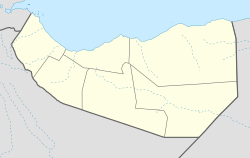
Horufadhi is a town in the Togdheer region of Somaliland which comes under the Buhoodle District.[1] The small town has a booming population.
Demographics
The Horufadhi town is primarily inhabited by people from the Somali ethnic group, with Muhammed Abokor sub-clan of Habar Jeclo well represented.
References
External links

