Clarach Bay: Difference between revisions
Appearance
Content deleted Content added
Coordinates |
Rescuing 1 sources and tagging 0 as dead. #IABot (v1.5beta) |
||
| Line 11: | Line 11: | ||
}} |
}} |
||
== External links == |
== External links == |
||
*[http://www.aberystwyth.org.uk/reg04.shtml Illustrated description] |
*[https://web.archive.org/web/20061015000044/http://www.aberystwyth.org.uk/reg04.shtml Illustrated description] |
||
*[http://www.geograph.org.uk/search.php?i=3091791 www.geograph.co.uk : photos of Clarach Bay and surrounding area] |
*[http://www.geograph.org.uk/search.php?i=3091791 www.geograph.co.uk : photos of Clarach Bay and surrounding area] |
||
Revision as of 20:38, 8 August 2017
52°26′3.08″N 4°4′57.14″W / 52.4341889°N 4.0825389°W
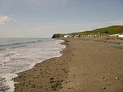
Clarach Bay is a small bay on the coast of Ceredigion, Wales, to the north of Aberystwyth, where the Afon Clarach flows into the sea. It has given its name to extensive nearby caravan and camping sites for holidaymakers.
Clarach Bay
-
View of Clarach Bay from Constitution Hill, Aberystwyth
-
Clarach Bay, from the coastal path into Aberystwyth
-
The beach at Clarach Bay


