Dog Hole Cave: Difference between revisions
JJMC89 bot (talk | contribs) Migrate {{Infobox cave}} coordinates parameters to {{Coord}}, see Wikipedia:Coordinates in infoboxes |
Rescuing 1 sources and tagging 2 as dead. #IABot (v1.5.1) |
||
| Line 21: | Line 21: | ||
| elevation = {{convert|60|m|ft}}<ref name=nc /> |
| elevation = {{convert|60|m|ft}}<ref name=nc /> |
||
| discovery = |
| discovery = |
||
| geology = Carboniferous limestone<ref name=NatEng>{{cite web|title=Morecambe Bay Natural Area profile|url=http://www.naturalareas.naturalengland.org.uk/Science/natural/profiles%5CnaProfile118.pdf|publisher=Natural England|accessdate=30 December 2013}}</ref> |
| geology = Carboniferous limestone<ref name=NatEng>{{cite web|title=Morecambe Bay Natural Area profile|url=http://www.naturalareas.naturalengland.org.uk/Science/natural/profiles%5CnaProfile118.pdf|publisher=Natural England|accessdate=30 December 2013}}{{dead link|date=September 2017 |bot=InternetArchiveBot |fix-attempted=yes }}</ref> |
||
| entrance_count = 1 |
| entrance_count = 1 |
||
| entrance_list = |
| entrance_list = |
||
| Line 35: | Line 35: | ||
| website = |
| website = |
||
}} |
}} |
||
'''Dog Hole Cave''' is an archaeologically significant cave near [[Storth]], [[Cumbria]], England.<ref name=two>{{cite web|last=Wilkinson|first=David M.|title=A tale of two caves: the history of archaeological exploration at Haverbrack and Helsfell in southern Cumbria|url=http://www.ljmu.ac.uk/BIE/Cave_history.pdf|accessdate=16 October 2011|author2=Hannah J. O'Regan|author3=Tom Clare|year=2005}}</ref> Other names for the cave include '''Haverbrack Bank Pot''',<ref name=geograph>{{cite web|title=The Dog Hole|url=http://www.geograph.org.uk/photo/1681847|work=Geograph|accessdate=16 October 2011}}, quoting "Underground in Furness, Eric G. Holland 1967"</ref> '''Haverbrack Dog Hole''',<ref name=RRCPC>{{cite journal|last=Newton|first=Jim|title=Haverbrack Dog Hole|journal=Red Rose Caving and Pothole Club Newsletter|date=November 2005|volume=42|issue=2|url=http://www.rrcpc.org.uk/newsletters/NL_V42_N2_A6.htm|accessdate=16 October 2011}}</ref> '''Fairy Cave''',<ref name=geograph /> '''The Dog Hole'''<ref name=geograph /> and '''Doghole Cave'''.<ref name=LJMU>{{cite web|url=http://www.ljmu.ac.uk/RCEAP/81121.htm| |
'''Dog Hole Cave''' is an archaeologically significant cave near [[Storth]], [[Cumbria]], England.<ref name=two>{{cite web|last=Wilkinson|first=David M.|title=A tale of two caves: the history of archaeological exploration at Haverbrack and Helsfell in southern Cumbria|url=http://www.ljmu.ac.uk/BIE/Cave_history.pdf|accessdate=16 October 2011|author2=Hannah J. O'Regan|author3=Tom Clare|year=2005}}{{dead link|date=September 2017 |bot=InternetArchiveBot |fix-attempted=yes }}</ref> Other names for the cave include '''Haverbrack Bank Pot''',<ref name=geograph>{{cite web|title=The Dog Hole|url=http://www.geograph.org.uk/photo/1681847|work=Geograph|accessdate=16 October 2011}}, quoting "Underground in Furness, Eric G. Holland 1967"</ref> '''Haverbrack Dog Hole''',<ref name=RRCPC>{{cite journal|last=Newton|first=Jim|title=Haverbrack Dog Hole|journal=Red Rose Caving and Pothole Club Newsletter|date=November 2005|volume=42|issue=2|url=http://www.rrcpc.org.uk/newsletters/NL_V42_N2_A6.htm|accessdate=16 October 2011}}</ref> '''Fairy Cave''',<ref name=geograph /> '''The Dog Hole'''<ref name=geograph /> and '''Doghole Cave'''.<ref name=LJMU>{{cite web|url=http://www.ljmu.ac.uk/RCEAP/81121.htm|last=O'Regan|first=Hannah|title=Doghole Cave, Haverbrack|work=Liverpool John Moores University, Fossil Mammal Research Group|accessdate=16 October 2011|year=2009|deadurl=yes|archiveurl=https://web.archive.org/web/20111028172238/http://www.ljmu.ac.uk/RCEAP/81121.htm|archivedate=28 October 2011|df=}}</ref> It consists of a largely excavated {{convert|12|m|ft}} shaft formed in Carboniferous limestone with {{convert|6|m|ft}} of steeply dipping phreatic tube at the bottom.<ref name=RRCPC /><ref name=NatEng /> |
||
It was originally excavated by J. W. ("Wilfred") Jackson in 1912; by local scouts in the 1950s; and by researchers from [[Liverpool John Moores University]] in 2003 and more recently. Jackson found domestic animal bones (dogs, pigs) some of which are in the [[Natural History Museum, London|Natural History Museum]], and the scouts also found human bones.<ref name=two /><ref name=LJMU /> The cave was gated in the 1980s to protect the archaeology, but inspection in 2003 showed that this had been destroyed.<ref name=LJMU /> |
It was originally excavated by J. W. ("Wilfred") Jackson in 1912; by local scouts in the 1950s; and by researchers from [[Liverpool John Moores University]] in 2003 and more recently. Jackson found domestic animal bones (dogs, pigs) some of which are in the [[Natural History Museum, London|Natural History Museum]], and the scouts also found human bones.<ref name=two /><ref name=LJMU /> The cave was gated in the 1980s to protect the archaeology, but inspection in 2003 showed that this had been destroyed.<ref name=LJMU /> |
||
Revision as of 01:06, 12 September 2017
| Dog Hole | |
|---|---|
| Haverbrack Bank Pot | |
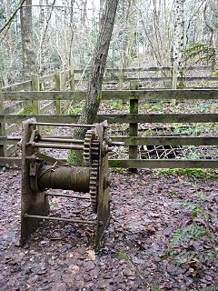
 The cave entrance in January 2010 | |
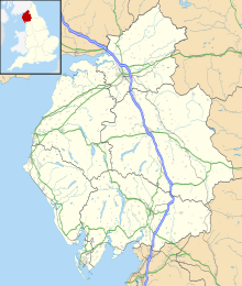
| Location | Storth, Cumbria, England |
| OS grid | SD 4826 8019 |
| Coordinates | 54°12′54″N 2°47′39″W / 54.21491°N 2.794288°W |
| Depth | 12 metres (39 ft)[1] |
| Length | 6 metres (20 ft)[2] |
| Elevation | 60 metres (200 ft)[1] |
| Geology | Carboniferous limestone[3] |
| Entrances | 1 |
| Difficulty | II [1] |
Dog Hole Cave is an archaeologically significant cave near Storth, Cumbria, England.[4] Other names for the cave include Haverbrack Bank Pot,[5] Haverbrack Dog Hole,[2] Fairy Cave,[5] The Dog Hole[5] and Doghole Cave.[6] It consists of a largely excavated 12 metres (39 ft) shaft formed in Carboniferous limestone with 6 metres (20 ft) of steeply dipping phreatic tube at the bottom.[2][3]
It was originally excavated by J. W. ("Wilfred") Jackson in 1912; by local scouts in the 1950s; and by researchers from Liverpool John Moores University in 2003 and more recently. Jackson found domestic animal bones (dogs, pigs) some of which are in the Natural History Museum, and the scouts also found human bones.[4][6] The cave was gated in the 1980s to protect the archaeology, but inspection in 2003 showed that this had been destroyed.[6]
Radio carbon dating of the deposits have provided dates ranging from Romano-British to Early Medieval.[6]
References
- ^ a b c Brook, Dave (1994). Northern Caves Volume 3. The Three Counties System and the North West. Skipton: Dalesman Publishing Company Ltd. p. 271. ISBN 1855680831.
- ^ a b c Newton, Jim (November 2005). "Haverbrack Dog Hole". Red Rose Caving and Pothole Club Newsletter. 42 (2). Retrieved 16 October 2011.
- ^ a b "Morecambe Bay Natural Area profile" (PDF). Natural England. Retrieved 30 December 2013.[permanent dead link]
- ^ a b Wilkinson, David M.; Hannah J. O'Regan; Tom Clare (2005). "A tale of two caves: the history of archaeological exploration at Haverbrack and Helsfell in southern Cumbria" (PDF). Retrieved 16 October 2011.[permanent dead link]
- ^ a b c "The Dog Hole". Geograph. Retrieved 16 October 2011., quoting "Underground in Furness, Eric G. Holland 1967"
- ^ a b c d O'Regan, Hannah (2009). "Doghole Cave, Haverbrack". Liverpool John Moores University, Fossil Mammal Research Group. Archived from the original on 28 October 2011. Retrieved 16 October 2011.
{{cite web}}: Unknown parameter|deadurl=ignored (|url-status=suggested) (help)

