Taborio: Difference between revisions
Appearance
Content deleted Content added
mNo edit summary |
m I added information about the Island. I also cited where this information was gotten from. |
||
| Line 1: | Line 1: | ||
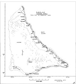
[[File:Tarawa Map.jpg|thumb|250px|Map of the Tarawa atoll]] |
[[File:Tarawa Map.jpg|thumb|250px|Map of the Tarawa atoll]] |
||
'''Taborio''' is a settlement on the island of [[Tarawa]], [[Kiribati]], where the Immaculate Heart College, a Catholic school, is situated. |
'''Taborio''' is a settlement on the island of [[Tarawa]], [[Kiribati]], where the Immaculate Heart College, a Catholic school, is situated. |
||
'''Taborio''' is situated on three and a half hectares of land surrounded by sea on all sides or reef-mud at low tide except where it is joined onto Nootoue village on its southern end<ref>{{Cite book|title=Telling Pacific Lives - Prisms of Process|last=Luker|first=Vicki|publisher=ANU E Press|year=2008|isbn=9781921313813|location=Australia|pages=127}}</ref>. |
|||
{{coord|1|30|N|173|01|E|display=title|region:KI-G_type:city_source:GNS-enwiki}} |
{{coord|1|30|N|173|01|E|display=title|region:KI-G_type:city_source:GNS-enwiki}} |
||
Revision as of 10:19, 26 July 2019

Taborio is a settlement on the island of Tarawa, Kiribati, where the Immaculate Heart College, a Catholic school, is situated.
Taborio is situated on three and a half hectares of land surrounded by sea on all sides or reef-mud at low tide except where it is joined onto Nootoue village on its southern end[1].
1°30′N 173°01′E / 1.500°N 173.017°E
- ^ Luker, Vicki (2008). Telling Pacific Lives - Prisms of Process. Australia: ANU E Press. p. 127. ISBN 9781921313813.
