
File:Armenia location map.svg

Size of this PNG preview of this SVG file: 585 × 600 pixels. Other resolutions: 234 × 240 pixels | 468 × 480 pixels | 749 × 768 pixels | 999 × 1,024 pixels | 1,998 × 2,048 pixels | 1,169 × 1,198 pixels.
Original file (SVG file, nominally 1,169 × 1,198 pixels, file size: 77 KB)
| This is a file from the Wikimedia Commons. Information from its description page there is shown below. Commons is a freely licensed media file repository. You can help. |

|
The boundaries on this map show the de facto situation. This is just one of several different views on the subject (see COM:NPOV). |
Summary
| Description |
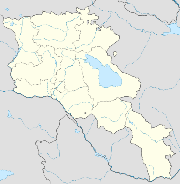
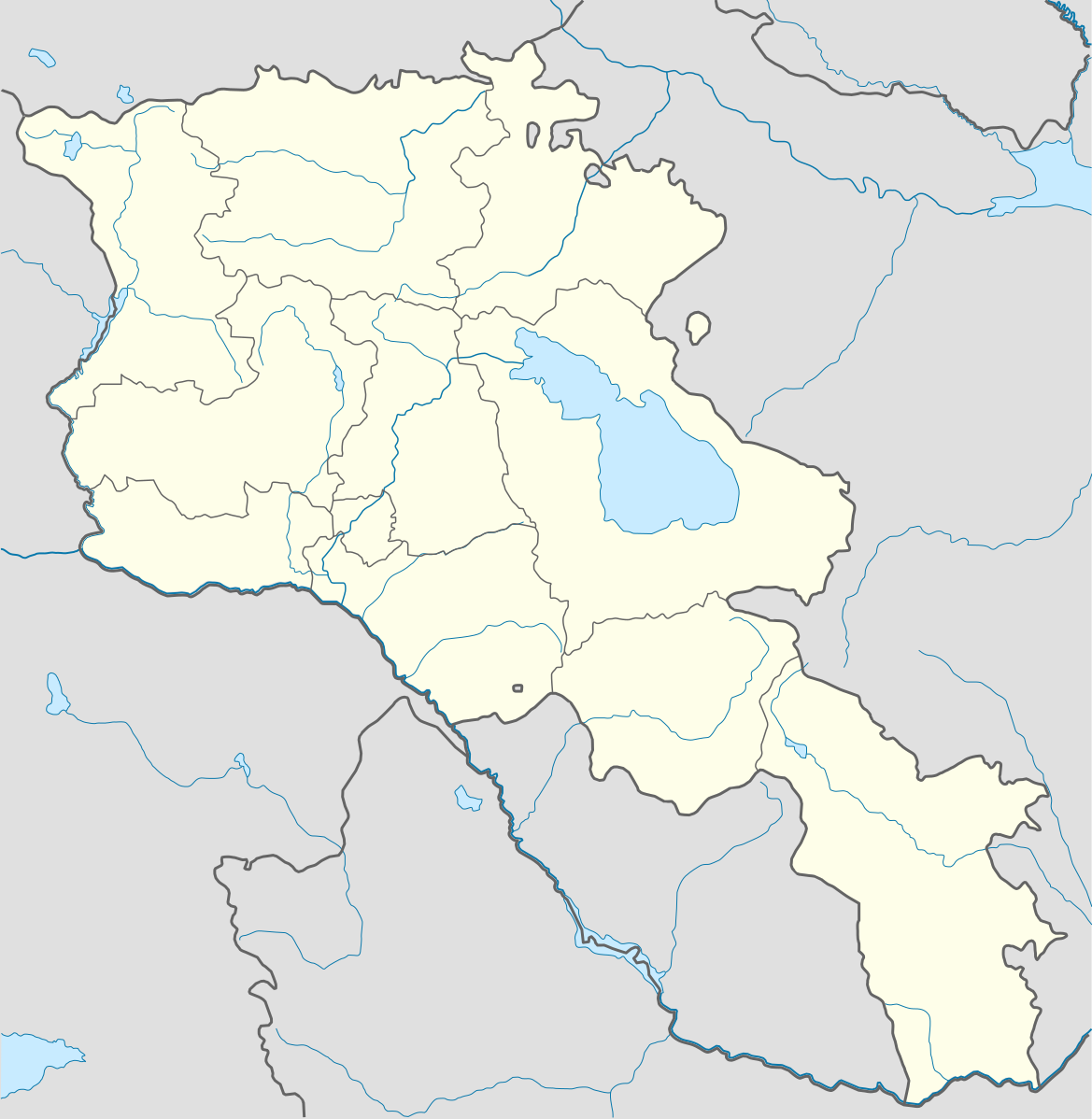
Deutsch: Positionskarte von Armenien. Quadratische Plattkarte, N-S-Streckung 130 %. Geographische Begrenzung der Karte:
English: Location map of Armenia. Equirectangular projection, N/S stretching 130 %. Geographic limits of the map:
Français : Carte administrative muette de l'Arménie. Projection cylindrique équidistante, avec étirement nord-sud de 130%.
|
||
| Date | |||
| Source |
Own work, using
|
||
| Author | NordNordWest | ||
| Other versions | Derivative works of this file: Am-map he.svg | ||
| SVG development | |||
| Graphic Lab |
|

Licensing
I, the copyright holder of this work, hereby publish it under the following license:
This file is licensed under the Creative Commons Attribution-Share Alike 3.0 Unported license.
- You are free:
- to share – to copy, distribute and transmit the work
- to remix – to adapt the work
- Under the following conditions:
- attribution – You must give appropriate credit, provide a link to the license, and indicate if changes were made. You may do so in any reasonable manner, but not in any way that suggests the licensor endorses you or your use.
- share alike – If you remix, transform, or build upon the material, you must distribute your contributions under the same or compatible license as the original.
File history
Click on a date/time to view the file as it appeared at that time.
| Date/Time | Thumbnail | Dimensions | User | Comment | |
|---|---|---|---|---|---|
| 17:18, 18 January 2014 |  | 1,169 × 1,198 (154 KB) | NordNordWest | + de facto border | |
| 19:55, 5 April 2012 |  | 1,169 × 1,198 (209 KB) | Sémhur | ...with the former size | |
| 19:47, 5 April 2012 |  | 1,000 × 1,024 (208 KB) | Sémhur | Adding few rivers : Dzoraget, Aghstafa, Azat, Vedi and Megri | |
| 11:52, 15 January 2011 |  | 1,169 × 1,198 (271 KB) | NordNordWest | according to http://commons.wikimedia.org/w/index.php?title=User_talk%3AVarmin&action=historysubmit&diff=48288330&oldid=40674250 | |
| 17:54, 14 January 2011 |  | 1,160 × 1,190 (286 KB) | Varmin | concordance avec les autres cartes vectorisée. | |
| 16:58, 28 August 2010 |  | 1,169 × 1,198 (271 KB) | NordNordWest | Barxudarlı, Yuxarı Əskipara and Karki stay officially non-Armenian (see en:List of enclaves and exclaves), no changes without discussion | |
| 16:34, 28 August 2010 |  | 1,160 × 1,190 (286 KB) | Ankax Hayastan | (Exclaves deleted according to official map at http://www.gov.am/en/regions/) | |
| 09:11, 21 October 2009 |  | 1,169 × 1,198 (271 KB) | NordNordWest | ||
| 13:24, 19 October 2009 |  | 1,169 × 1,198 (269 KB) | NordNordWest | ||
| 14:36, 11 August 2009 |  | 1,169 × 1,198 (269 KB) | NordNordWest | {{int:filedesc}} {{Information |Description= {{de|Positionskarte von Armenien}} Quadratische Plattkarte, N-S-Streckung 130 %. Geographische Begrenzung der Karte: * N: 41.4° N * S: 38.8° N * W: 43.4° O * O: 46.7° O {{en|Location map of |
File usage
The following pages on the English Wikipedia use this file (pages on other projects are not listed):
Global file usage
The following other wikis use this file:
- Usage on av.wikipedia.org
- Usage on az.wikisource.org
- Usage on ba.wikipedia.org
- Usage on bn.wikipedia.org
- Usage on bs.wikipedia.org
- Usage on ckb.wikipedia.org
- Usage on de.wikipedia.org
- Usage on de.wikivoyage.org
- Usage on eo.wikipedia.org
- Usage on es.wikipedia.org
- Usage on fa.wikipedia.org
- Usage on fr.wikipedia.org
- Stade Hrazdan
- Stade Républicain Vazgen-Sargsian
- Stade Mika
- Stade Alashkert
- Stade Kasakhi Marzik
- Université d'État d'ingénierie d'Arménie
- Projet:Cartographie/Cartes standards/Pays
- Mausolée d'Aghdsk
- Erablur
- Université française en Arménie
- Wikipédia:Atelier graphique/Cartes/Archives/avril 2012
- Cimetière de Noradouz
- Université américaine d'Arménie
- Cinéma Moscou
- Maison-musée Vazgen-Sargsian
- Module:Carte/données/arménie
- Musée historique de Sisian
- Stade Urartu
- Stade de l'Académie de football d'Erevan
- Usage on hy.wikipedia.org
- Usage on incubator.wikimedia.org
View more global usage of this file.