Search results
Appearance
The page ""Portolan" journal" does not exist. You can create a draft and submit it for review or request that a redirect be created, but consider checking the search results below to see whether the topic is already covered.
- Portolan charts are nautical charts, first made in the 13th century in the Mediterranean basin and later expanded to include other regions. The word portolan...19 KB (2,309 words) - 12:29, 24 August 2024
- notable 14th-century portolan charts, the "Dalorto" chart of 1325 and the "Dulcert" chart of 1339. The latter is the first portolan known to have been produced...16 KB (1,913 words) - 13:51, 28 June 2024
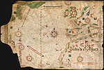
- partial copy of an otherwise lost map by Christopher Columbus. The map is a portolan chart with compass roses and a windrose network for navigation, rather...58 KB (6,813 words) - 16:07, 1 November 2024
- handbooks, hence the term portolan charts. The wealth of detail contained in portolano handbooks is reflected in the portolan charts, stunningly accurate...14 KB (1,667 words) - 17:51, 26 April 2024
- portolan chart by Angelino Dulcert. It also appeared on the Catalan Atlas, in 1375. One of the earliest appearances was on the Rex Tholomeus portolan...14 KB (1,165 words) - 03:30, 13 October 2024
- The Pizzigani brothers are principally known for the construction of a portolan chart, signed and dated 1367, currently held by the Biblioteca Palatina...12 KB (1,523 words) - 22:10, 20 October 2023
- The map is a portolan chart with compass roses from which lines of bearing radiate. Designed for navigation via dead reckoning, portolan charts use a...61 KB (6,541 words) - 10:49, 1 November 2024
- Medici Atlas (Laurentian Gaddiano portolan). This town ("Isingan") is fantastically depicted in the 1413 portolan map of Majorcan cartographer Mecia...47 KB (5,783 words) - 12:43, 22 October 2024
- The Weimar map is an anonymous 15th-century Italian portolan chart, held by the Grand Ducal Library of Weimar. Although frequently dated as 1424, most...7 KB (899 words) - 17:43, 21 March 2024
- its first explicit appearance as a large rectangular island in the 1424 portolan chart of Zuane Pizzigano. Thereafter, it routinely appeared in most nautical...40 KB (5,237 words) - 13:43, 23 October 2024
- Claude Portolan (born 16 December 1960) is a French former international rugby union player. A product of hometown club SA Auterive, Portolan was a prop...2 KB (165 words) - 21:59, 3 October 2024
- investigations of map projections and the appearance of portolano and then portolan charts for plying the European trade routes were rare innovations of the...143 KB (17,630 words) - 05:40, 24 October 2024
- the Washington Map Society”, Portolan, No 49, Winter 2000-01, pp.18 Lourie, I., “The Atlases of A. J. Johnson”, Portolan, No 49, Winter 2000-01, pp.7-17...3 KB (439 words) - 16:26, 29 September 2020
- the royal workshops. Reinel was the author of one of the oldest signed Portolan charts, tentatively dated about 1485. This nautical chart depicts the western...6 KB (715 words) - 13:41, 4 May 2024
- activity spans from 1502 to 1533. Pilestrina is known for his work on portolan charts, and he was active with the Majorcan cartographic school. He created...6 KB (535 words) - 16:48, 22 August 2024
- incomparabilis". Two copies of maps by Fra Mauro are known to survive. One is a portolan chart in the Vatican Library, (Codice Borgiano V) published by Roberto...9 KB (1,214 words) - 09:32, 1 February 2024
- Gulf of Honduras (section Journals)[scale not provided]. Manuscript portolan atlas of the world; Newberry Library Ayer MS map 13. sp. anon. (c. 1560). [Portolan chart of the Caribbean and Americas]...58 KB (4,849 words) - 02:53, 29 June 2024
- Globe: Journal of the Australian Map Circle, No. 62, 2009, pp. 1–50. Robert J. King, "Regio Patalis: Australia on the map in 1531?", The Portolan, Issue...5 KB (514 words) - 01:30, 9 August 2024
- lines on portolans when portolans were in use, as well as always applicable to straight lines on Mercator charts. For short distances portolan "rhumbs"...21 KB (2,850 words) - 18:11, 11 October 2024
- equirectangular projection instead. In the 13th century, the earliest extant portolan charts of the Mediterranean sea, which are generally not believed to be...49 KB (6,748 words) - 19:46, 26 October 2024


