
File:PHcd caloocan 1st.png
Size of this preview: 519 × 599 pixels. Other resolutions: 208 × 240 pixels | 416 × 480 pixels | 900 × 1,039 pixels.
Original file (900 × 1,039 pixels, file size: 214 KB, MIME type: image/png)
Summary
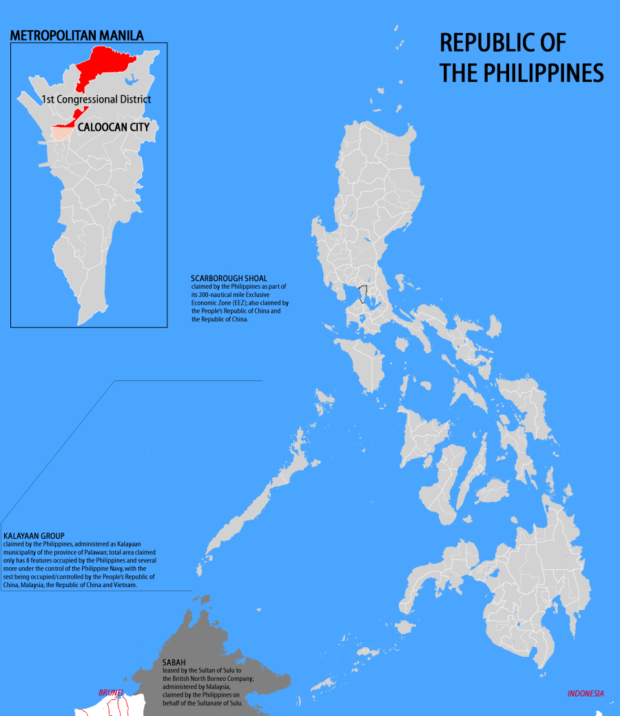
Map showing the First Congressional District of the City of Caloocan.
Credit for most provincial and city boundaries go to Coffee.
Licensing
I, the copyright holder of this work, hereby publish it under the following licenses:
 | Permission is granted to copy, distribute and/or modify this document under the terms of the GNU Free Documentation License, Version 1.2 or any later version published by the Free Software Foundation; with no Invariant Sections, no Front-Cover Texts, and no Back-Cover Texts. |
| This work is licensed under the Creative Commons Attribution-ShareAlike 3.0 License. This licensing tag was added to this file as part of the GFDL licensing update. |
| This file is licensed under the Creative Commons Attribution-ShareAlike license versions 2.5, 2.0, and 1.0. |
You may select the license of your choice.
 | This file is a candidate to be copied to Wikimedia Commons.
Any user may perform this transfer; refer to Wikipedia:Moving files to Commons for details. If this file has problems with attribution, copyright, or is otherwise ineligible for Commons, then remove this tag and DO NOT transfer it; repeat violators may be blocked from editing. Other Instructions
| ||
| |||
File history
Click on a date/time to view the file as it appeared at that time.
| Date/Time | Thumbnail | Dimensions | User | Comment | |
|---|---|---|---|---|---|
| current | 06:34, 18 March 2007 | | 900 × 1,039 (214 KB) | Dakilang Isagani (talk | contribs) | Map showing the First Congressional District of the City of Caloocan. Credit for most provincial and city boundaries go to Coffee. |
You cannot overwrite this file.
File usage
The following page uses this file: