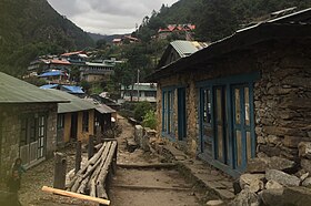
Monjo, Nepal
Appearance


Monjo is a small village in the Khumbu region of Nepal. It lies in the Dudh Kosi river valley just north of Phakding and south of Jorsale, at an altitude of 2,835 m,[1] just below the Sagarmatha National Park entrance gate and check-point,[2][3] one of the UNESCO World Heritage Site since 1979.
The trail start at Lukla and Monjo is often a stopping point for trekkers, as an alternative of Phakding, on their way to Sagarmartha (Mount Everest) via the Gokyo Ri route or Tengboche route.[2]
Its primary function of the village is to support the tourism industry and as such consists of a number of guesthouses.[2]
See also
References
- ^ [1] Archived 2011-02-07 at the Wayback Machine Nepal Map Publisher Ltd.& ISBN 978-9937-8062-1-3
- ^ a b c Bradley, Mayhew; "Trekking in the Nepal Himalaya"; (2009); 9 edição; p 94 (map)+ pp 103-104; Lonely Planet; ISBN 9781741041880
- ^ Bezruchka Stephen; "Trekking in the Nepal: a traveler's guide"; The Mountaineers ed.; Seattle; (2004); page 220; ISBN 0-89886-535-2
27°47′N 86°43′E / 27.783°N 86.717°E
