Jump to content

San Miguel Island (Philippines)

Coordinates: 13°22′31″N 123°48′28″E / 13.37528°N 123.80778°E / 13.37528; 123.80778
From Wikipedia, the free encyclopedia

This is the current revision of this page, as edited by Shipping address (talk | contribs) at 04:30, 2 October 2023. The present address (URL) is a permanent link to this version.

(diff) ← Previous revision | Latest revision (diff) | Newer revision → (diff)
San Miguel Island
San Miguel Island is located in Albay
San Miguel Island
San Miguel Island
Location within Albay
San Miguel Island is located in Luzon
San Miguel Island
San Miguel Island
San Miguel Island (Luzon)
San Miguel Island is located in Philippines
San Miguel Island
San Miguel Island
San Miguel Island (Philippines)
Geography
LocationLagonoy Gulf
Coordinates13°22′31″N 123°48′28″E / 13.37528°N 123.80778°E / 13.37528; 123.80778
Adjacent toPhilippine Sea
Administration
RegionBicol Region
ProvinceAlbay
CityTabaco
Barangays
  • Agnas
  • Hacienda
  • Rawis
  • Sagurong
  • Visita
Additional information
Map

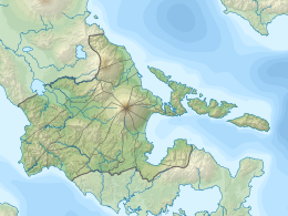
San Miguel Island is an island in the province of Albay in the Philippines located at the western end of the strip of islands in Lagonoy Gulf. The island is under the jurisdiction of the city of Tabaco, and comprises five barangays: Agnas, Hacienda, Rawis, Sagurong and Visita. The main economic activities are farming, fishing, basket and mat weaving, and cattle raising.