Vlierden
Vlierden | |
|---|---|
Village | |
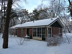
 Holiday home in the snow | |
| Coordinates: 51°26′44″N 5°45′29″E / 51.44556°N 5.75806°E | |
| Country | Netherlands |
| Province | North Brabant |
| Municipality | Deurne |
| Area | |
| • Total | 12.62 km2 (4.87 sq mi) |
| Elevation | 25 m (82 ft) |
| Population (2021)[1] | |
| • Total | 1,440 |
| • Density | 110/km2 (300/sq mi) |
| Time zone | UTC+1 (CET) |
| • Summer (DST) | UTC+2 (CEST) |
| Postal code | 5756[1] |
| Dialing code | 0493 |
Vlierden is a village in the Dutch province of North Brabant. It is located in the municipality of Deurne, about 20 km east of Eindhoven.
History
[edit]The village was first mentioned in 721 as Fleodrodu(m), and means "settlement near the elderberry (sambucus) trees".[3] Vlierden is an agrarian community from the Early Middle Ages. For a short while, it was a heerlijkheid.[4]
The St Willibrordus was originally built in 1846, and expanded in 1920. It was severely damaged in 1944, and received a new front in 1956.[4]
Vlierden was home to 217 people in 1840.[5] Vlierden was a separate municipality until 1926, when it merged with Deurne en Liessel to form the new municipality "Deurne".[6]
The spoken language is Peellands (an East Brabantian dialect, which is very similar to colloquial Dutch).[7]
Gallery
[edit]-
St Willibrordus Church
-
Farm in Vlierden
-
House in Vlierden
-
Ruins of the old church
References
[edit]- ^ a b c "Kerncijfers wijken en buurten 2021". Central Bureau of Statistics. Retrieved 15 April 2022.
- ^ "Postcodetool for 5756AA". Actueel Hoogtebestand Nederland (in Dutch). Het Waterschapshuis. Retrieved 15 April 2022.
- ^ "Vlierden - (geografische naam)". Etymologiebank (in Dutch). Retrieved 15 April 2022.
- ^ a b Chris Kolman & Ronald Stenvert (1997). Vlierden (in Dutch). Zwolle: Waanders. ISBN 90 400 9945 6. Retrieved 15 April 2022.
- ^ "Vlierden". Plaatsengids (in Dutch). Retrieved 15 April 2022.
- ^ Ad van der Meer and Onno Boonstra, Repertorium van Nederlandse gemeenten, KNAW, 2011.
- ^ Jos & Cor Swanenberg: Taal in stad en land: Oost-Brabants, ISBN 9012090105


