
Roosville, Montana
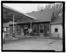
Roosville is an unincorporated community[1] and United States Port of Entry on the Canada–United States border[2] in Lincoln County, Montana, United States, at the terminus of US Highway 93. The locality on the Canadian side of the border is also named Roosville and is the southern terminus of British Columbia provincial highway 93.
References[edit]
Wikimedia Commons has media related to Roosville, Montana.
48°59′57″N 115°03′24″W / 48.99917°N 115.05667°W
Municipalities and communities of Lincoln County, Montana, United States | ||
|---|---|---|
| Cities |  | |
| Towns | ||
| CDPs | ||
| Other communities | ||
| International | |
|---|---|
| National | |
This Lincoln County, Montana state location article is a stub. You can help Wikipedia by expanding it. |