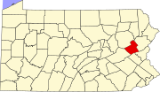
Packerton, Pennsylvania
Appearance
Packerton, Pennsylvania | |
|---|---|
Unincorporated community | |
 Zion Lutheran Church | |
| Coordinates: 40°51′18″N 75°43′09″W / 40.85500°N 75.71917°W | |
| Country | United States |
| State | Pennsylvania |
| County | Carbon |
| Township | Mahoning |
| Elevation | 738 ft (225 m) |
| Time zone | UTC-5 (Eastern (EST)) |
| • Summer (DST) | UTC-4 (EDT) |
| ZIP code | 18235 |
| Area code(s) | 610 and 484 |
| GNIS feature ID | 1183177[1] |
Packerton is a village located in Mahoning Township, Carbon County, Pennsylvania on the Lehigh River and U.S. Route 209 between Jim Thorpe and Lehighton. It uses the Lehighton ZIP code of 18235.


