EN1-ST05
Appearance
| EN1-ST05 | |
|---|---|
 The Pelourinho in Cidade Velha | |
| Route information | |
| Length | 7 km (4.3 mi) |
| Major junctions | |
| East end | West Praia |
| West end | Cidade Velha |
| Location | |
| Country | Cabo Verde |
| Regions | Santiago |
| Major cities | Cidade Velha |
| Highway system | |
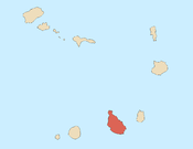
EN1-ST05 is a first class national road on the island of Santiago, Cape Verde. It runs from the western outskirts of the capital Praia to Cidade Velha.[1] It is 7 km long. In Praia it is connected with the Circular da Praia (EN1-ST06).
See also
[edit]References
[edit]- ^ Ilha de Santiago, Rede rodoviária[permanent dead link], Instituto de Estradas

