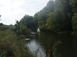
Veduga
Appearance
| Veduga | |
|---|---|
 | |
 | |
| Native name | Ведуга (Russian) |
| Location | |
| Country | Russia |
| Physical characteristics | |
| Mouth | Don |
• coordinates | 51°45′05″N 39°04′42″E / 51.7515°N 39.0784°E |
| Length | 94 km (58 mi) |
| Basin size | 1,570 km2 (610 sq mi) |
| Basin features | |
| Progression | Don→ Sea of Azov |
The Veduga (Russian: Ве́дуга) is a right tributary of the river Don, flowing through the northwestern corner of Voronezh Oblast in Russia. It is 94 kilometres (58 mi) long, and has a drainage basin of 1,570 square kilometres (610 sq mi).[1] It is meandering, never wider than 15 metres (49 ft), and never deeper than 3 metres (10 ft). There are settlements almost continuously along its banks; the nearest large town is Semiluki.
References
- ^ «Река Ведуга», Russian State Water Registry
