Boulevard du Montparnasse
Appearance
 Boulevard Montparnasse | |
| Length | 1,632 m (5,354 ft) |
|---|---|
| Width | 39 m (128 ft) |
| Arrondissement | 6th, 14th, 15th |
| Quarter | Notre-Dame des Champs . Necker . Montparnasse . |
| Coordinates | 48°50′34″N 2°19′38″E / 48.84278°N 2.32722°E |
| From | place Léon Paul Fargue |
| To | place Camille Jullian |
| Construction | |
| Completion | Lettres patentes du 9 août 1760 |
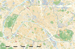
The Boulevard du Montparnasse is a two-way boulevard in Montparnasse, in the 6th, 14th and 15th arrondissements of Paris.
Situation
[edit]The boulevard runs south-eastward from the place Léon Paul Fargue to the Port-Royal (place Camille Jullian) and is 1.7km in length.[1] The Tour Montparnasse and place du 18 juin 1940 are located along it. During a period in his life when American writer Henry Miller had no money in the 1930s, he would sleep on a bench outside the Closerie des Lilas, a brasserie located at 171, Boulevard du Montparnasse.[2]
| Located near the Métro stations: Duroc, Vavin, Port-Royal and Montparnasse – Bienvenüe. |
See also
[edit]Wikimedia Commons has media related to Boulevard du Montparnasse (Paris).
References
[edit]- ^ Google Maps, accessed 13 April 2024
- ^ Paris Aéroport, Paris Vous Aime Magazine, No 13, avril-may-juin 2023, p. 122

