Monte Rosa tour
Appearance
You can help expand this article with text translated from the corresponding article in Italian. (August 2012) Click [show] for important translation instructions.
|
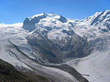
The Monte Rosa Tour is a circular hiking trail through the Swiss & Italian Alps around Monte Rosa (4634m). The tour also encircles the Dom (4,545 m) in the Mischabel range.

Typical overnight stops are
- Zermatt
- Theodulpass (highest point: 3,301 m)
- St-Jacques in the Ayas valley
- Gressoney-La-Trinité
- Alagna Valsesia
- Macugnaga-Staffa
- Saas-Fee
- Grächen
- Europahütte
The section from Saas-Fee to Grächen is sometimes known as the Balfrin Höhenweg, or "high path".
Grächen to Zermatt is along the Europaweg, and passes the Europa Hut.
