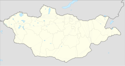
Baganuur
Baganuur District
Багануур дүүрэг ᠪᠠᠭᠠᠨᠠᠭᠤᠷᠲᠡᠭᠦᠷᠭᠡ | |
|---|---|
 A sign on a road leading to Baganuur | |
| Coordinates: 47°47′02″N 108°22′20″E / 47.78389°N 108.37222°E | |
| Country | Mongolia |
| Municipality | Ulaanbaatar |
| Raion of Ulaanbaatar | 1980 |
| Reorganized as district | 1992 |
| Government | |
| • Body | Citizens' Representatives Khural of the Baganuur district |
| • Governor of District | S.Davaasüren |
| Area | |
| • Total | 620.2 km2 (239.5 sq mi) |
| Elevation | 1,349 m (4,426 ft) |
| Population (2024) | |
| • Total | 28,926 |
| Time zone | UTC+8 (UTC + 8) |
| Area code | +976 (0) 21 |
| Website | http://bnd.ub.gov.mn/ |

Baganuur (Mongolian: Багануур, ᠪᠠᠭᠠᠨᠠᠭᠤᠷ, Little Lake) is one of nine düüregs (districts) of the Mongolian capital of Ulaanbaatar. It is subdivided into six khoroos (subdistricts).
Baganuur is a distanced district, located as an exclave of 620 square kilometres (239 sq mi) on the border between the Töv and Khentii aimags. It was created as a Soviet army base for the 12th Motor Rifle Division. Later the largest open-pit coal mine in Mongolia was built here. Baganuur city is one of the largest industrial production locations in Mongolia, especially coal mining and would rank among the country's ten largest cities. There are efforts under way to separate its administration from the capital to make it an independent city.
Transportation
Baganuur is the endpoint of a side line of the Trans-Mongolian Railway, which connects to the main line in Bagakhangai. Due to high operation cost, Mongolian Railway had stopped passenger service on the Ulaanbaatar-Baganuur-Ulaanbaatar, although freight trains still normally transport coal to Ulaanbaatar and other neighbouring towns. Baganuur is also accessible via 138 km of paved road completed in 2004.
2008 methanol scare
On December 31, 2007, Baganuur became the center of a massive methanol poisoning case that stemmed from substandard production methods of a local vodka manufacturer. The poison killed 14 people and hospitalized dozens of others. This case led to a complete ban of vodka sales in Ulaanbaatar for several days, and also highlighted one of Mongolia's food safety problems.[1][2]
Climate
Baganuur has a dry-winter subarctic climate (Köppen Dwc).
| Climate data for Baganuur, 1991–2010 | |||||||||||||
|---|---|---|---|---|---|---|---|---|---|---|---|---|---|
| Month | Jan | Feb | Mar | Apr | May | Jun | Jul | Aug | Sep | Oct | Nov | Dec | Year |
| Mean daily maximum °C (°F) | −17.6 (0.3) |
−10.8 (12.6) |
−1.4 (29.5) |
9.4 (48.9) |
17.6 (63.7) |
23.0 (73.4) |
24.6 (76.3) |
22.5 (72.5) |
16.8 (62.2) |
7.1 (44.8) |
−5.7 (21.7) |
−14.9 (5.2) |
5.9 (42.6) |
| Mean daily minimum °C (°F) | −34.0 (−29.2) |
−27.8 (−18.0) |
−18.0 (−0.4) |
−7.0 (19.4) |
0.6 (33.1) |
7.4 (45.3) |
10.9 (51.6) |
8.3 (46.9) |
0.6 (33.1) |
−8.3 (17.1) |
−22.5 (−8.5) |
−30.8 (−23.4) |
−10.0 (13.9) |
| Average precipitation mm (inches) | 2.5 (0.10) |
2.3 (0.09) |
4.0 (0.16) |
6.1 (0.24) |
18.3 (0.72) |
36.4 (1.43) |
57.2 (2.25) |
51.1 (2.01) |
20.9 (0.82) |
8.6 (0.34) |
4.0 (0.16) |
3.7 (0.15) |
215.1 (8.47) |
| Average precipitation days | 3.8 | 3.4 | 4.5 | 5.8 | 7.2 | 12.9 | 16.5 | 13.8 | 7.9 | 4.9 | 4.4 | 3.8 | 88.9 |
| Source: World Meteorological Organization[3] | |||||||||||||
References
- ^ "UBPost: 11 Dead, Dozens of Others Poisoned by Tainted Vodka". Archived from the original on 2008-01-07. Retrieved 2008-01-13.
- ^ "UBPost: Illegal Vodka Production Uncovered in Police Raid". Archived from the original on 2008-01-11. Retrieved 2008-01-13.
- ^ "World Weather Information Service – Baganuur district". World Meteorological Organization. Retrieved November 3, 2022.


