Xaloztoc
Appearance
You can help expand this article with text translated from the corresponding article in Spanish. (July 2010) Click [show] for important translation instructions.
|
You can help expand this article with text translated from the corresponding article in Esperanto. (July 2010) Click [show] for important translation instructions. Content in this edit is translated from the existing Esperanto Wikipedia article at [[:eo:Xaloztoc (komunumo)]]; see its history for attribution.{{Translated|eo|Xaloztoc (komunumo)}} to the talk page. |
Xaloztoc | |
|---|---|
 | |
 | |
| Coordinates: 19°24′00″N 98°3′0″W / 19.40000°N 98.05000°W | |
| Country | |
| State | |
| Established | 25 November 1873 |
| Area | |
| • Total | 49 km2 (19 sq mi) |
| Elevation | 2,500 m (8,200 ft) |
| Population (2010) | |
| • Total | 21,769 |
| • Density | 444.27/km2 (1,150.7/sq mi) |
| Time zone | UTC-6 (Central) |
| Area code | 241 |
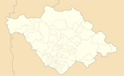
Xaloztoc is a town and its surrounding municipality in the Mexican state of Tlaxcala. It is one of 60 municipalities in the state. The INEGI reference number for the municipality is 29039.[1]
Geography
[edit]As of 2010, Xaloztoc has an estimated 21,769 residents. The size of the municipality is about 49 km2 (19 sq mi). The average elevation is 2,500 meters (8,200 ft) above sea level.
Climate
[edit]On average, Xaloztoc receives 730.3 mm/m2 (28.8 in) of precipitation annually. The average yearly temperature for the area is approximately 14.8 °C (58.6 °F).
References
[edit]- ^ "Estado de Tlaxcala". Archived from the original on 19 Sep 2004. Retrieved March 6, 2023.


