Magyarnándor
Appearance
From Wikipedia, the free encyclopedia
This is the current revision of this page, as edited by 1ctinus (talk | contribs) at 15:09, 16 July 2024 (Hungary shortdescs). The present address (URL) is a permanent link to this version.
(diff) ← Previous revision | Latest revision (diff) | Newer revision → (diff)
Village in Nógrád County, Hungary
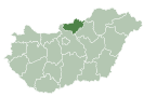
Magyarnándor is a village in Nógrád County, Hungary with 1,097 inhabitants (2014).
47°58′N 19°20′E / 47.967°N 19.333°E / 47.967; 19.333
This Nógrád county location article is a stub. You can help Wikipedia by expanding it. |


