
Armoury Towers
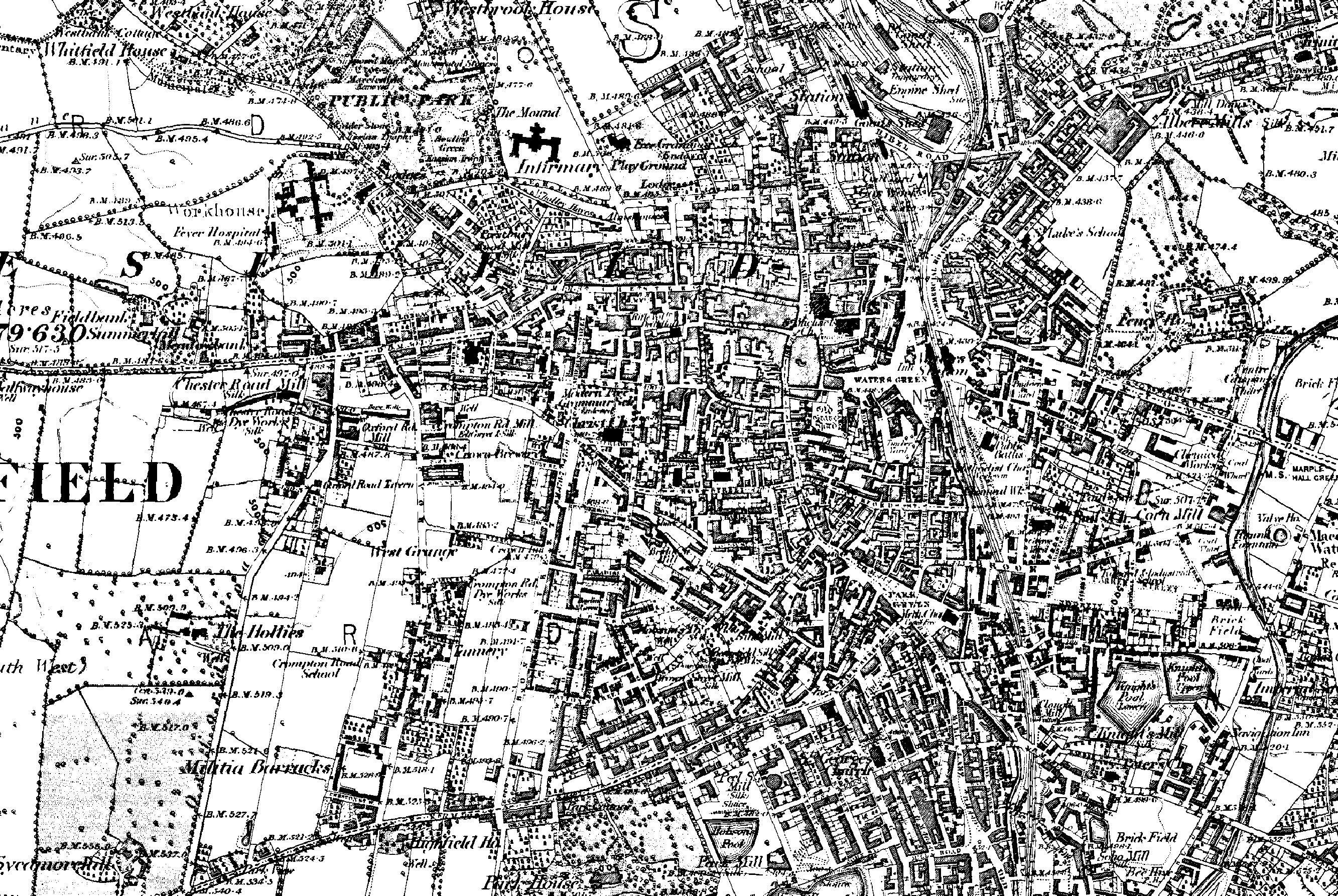
Barracks Square or the Militia Barracks is a square Macclesfield, England that was first developed in the 1850s for the military.[1] The barracks, consisting of married quarters, CO's quarters and the armoury were for the use of the permanent staff of the 2nd Royal Cheshire Militia.


This page is related to Barracks Square, Macclesfield, Cheshire, England, SK11 8HF. It aims to track the history of the Square. More history and photos needed please. Most information has been taken from the websites listed. Please correct any errors & add any information you have. Any pictures can be emailed to the page editor - please follow post on the discussion forum and I will pm you.
Military History
- Land off Crompton Road discussed for purchase in April 1852.
- In 1857 the County Quarter Sessions resolved that a barracks should be provided for the arms, stores and permanent staff of the 2nd Royal Cheshire Militia.[1]
- Designed by a local architect James Stevens, together with a Mr Pownall of London. The buildings were completed in 1858-1859.[1]
- The Barracks was built as the home of the 2nd Royal Cheshire Militia in 1858-1859 by Mr W H Brown from Stockport.
- 1914 Kelly also noted that 'The D Squadron, The Cheshire (Earl of Chester's) Yeomanry Territorial Force have head quarters at The Barracks, Crompton road.
Civilian History
- 1918 the barracks became private dwellings. The armoury became a store for general industry[1] and was used as a cork factor and pig farm at different times.
- A some time a printing company called Sherratts used to let some rooms at the Barracks. The company also had premises on Thorpe Street and Lower Heyes at one time or another. Sherratts also apparently had a small golf course in Higher Hurdsfield at one time.
- 11 October 1973. Grade II listed status granted.
- 1977 - The old Armoury (later Armoury Towers) was converted for use as a night club. The Armoury Club was set up by a Mr Peter Hague, who had a connection with the Tarmac Quarry in Gawsworth.
- 1977 - The whole barracks was declared a conservation area.[1]
- 1984 - Demolition of 13 garages and entrance to old nightclub. Extension to rear.
- 1989 - Old nightclub converted to self contained apartments.
- 2006 - Drummer's Keep and Evington House were renovated. Evington House had previously been used as a plumber's merchants, whilst Drummer's Keep was a timber / builders yard.
- 2007 - Barracks Square Renovation Committee formed.
- 2008 - Central garden removed to allow original drains to be replaced. New garden built by residents upon receipt of grants from Gerald Grosvenor, 6th Duke of Westminster and Peter Jones.
- 2009 - New flagpole donated by Sir Nicholas Winterton DL MP.
- 2009 - Perimeter wall to Armoury Court Mews / Crompton Road repaired. Macclesfield Civic Society award presented.
- 2009 - Clock mechanism replaced.
- 2010 - Main parade ground resurfaced by donations from residents.
- 27 April 2011 - Awarded Macclesfield Civic Society award for the renovation works.
Notes
References
- Home, Robert (1978). Macclesfield as it was. Nelson, Lancashire: Hendon Publishing Co Ltd. ISBN 0-860-67032-5.
Photographs
To see old and new photos visit here and go to the "public" tab to see photos old and new - including the 2010 renovation, press releases, etc..
Electoral Rolls & Censuses
Electoral rolls (1945 - 1974) and censuses (1871-1911) are here.
Video
See some video footage
Other useful links
- 1882 Ordnance Survey map
- View Barracks Square on Google Maps.