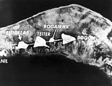
Elugelab
Appearance


Elugelab (or Elugelap) was an island, part of the Enewetak atoll in the Marshall Islands. It was destroyed by the world's first test of a hydrogen bomb on 1 November 1952, as part of Operation Ivy. The blast yielded 10.4 megatons of explosive energy, 750 times[1] the explosion that leveled central Hiroshima,[2] leaving only a crater where Elugelab had been.
See also
References
11°40′0″N 162°11′13″E / 11.66667°N 162.18694°E
- ^ In Mortal Hands, A Cautionary History of the Nuclear Age, by Stephanie Cooke, Bloomsbury, New York, 2009, p. 103.
- ^ "Soviets Stole Bomb Idea From U.S., Book Says". The New York Times. 30 December 2008. Retrieved 2008-12-29.
{{cite news}}:|first=missing|last=(help)
External links
- "Mike" Test from PBS
