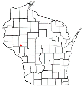
Cleghorn, Wisconsin

Cleghorn is an unincorporated community in the east central part of the town of Pleasant Valley in Eau Claire County, Wisconsin, United States, about six miles south of Eau Claire.[1][2] Cleghorn is located one mile east of Wis. 93 along Eau Claire County Highway "HH", at the junction of "HH", "I", and "V". The now-extinct community of Hadleyville lies approximately three miles to the west, along Eau Claire County Highway "HH".
Government
The community is the site of the town's administration.
History
Cleghorn was named after Lewis Cleghorn, one of its early settlers.[3] In 1913 the now-defunct Foster Railroad was extended from Foster through Allen as far as Cleghorn.
Sports/Humor
Cleghorn claims to be home of the UW Fighting Woodticks[4], a humorous team name. Shirts have been made by the Lion's Club to honor the fictional team.[5]
Notes
- ^ "Cleghorn, Wisconsin". Geographic Names Information System. United States Geological Survey, United States Department of the Interior.
- ^ Cleghorn, Wisconsin
- ^ Our Story, Vol V - Communities draw names from men, places, events
- ^ http://pleasantvalleyacres.org/
- ^ http://www.e-clubhouse.org/sites/cleghorn/photos.php

