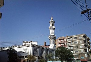
Mallawi
Appearance
Mallawi
ملوى | |
|---|---|
 | |
| Country | |
| Governorate | Minya |
| Time zone | UTC+2 (EST) |
Mallawi is a town in Egypt, located in the governorate of Minya.
Overview
Situated in a farm area, the town produces textiles and handicrafts.
The total area of the city is about 3 acres (12,000 m2). The southern limit is Allah Mansion (possibly a religious structure?), the northern limit is a television transmitter, the eastern border is the Nile, and the western boundary is Dirotiah Lake. The city contains many ancient Egyptian artifacts.
The name of the city is derived from two Akkadian words "mal" meaning land, and "lawi" a common last name, thus the common English translation "Land of the Levites."
See also
External links
27°44′N 30°50′E / 27.733°N 30.833°E Template:EgyptLargestCities
