
Burgstall Schlosshügel
| Burgstall Schlosshügel | |
|---|---|
Gurtstein? | |
| Weidenberg-Sophienthal-"Schlosshügel" | |
| File:Stierlein1791.JPG 1791 plan of the castle site by Johann Christoph Stierlein | |
 Burgstall Schlosshügel | |
| Coordinates | 49°57′13″N 11°46′16″E / 49.95348°N 11.77120°E |
| Type | hill castle, spur castle, motte |
| Code | DE-BY |
| Height | 699 m above sea level (NN) |
| Site information | |
| Condition | Burgstall with recognisable moats and ramparts |
| Site history | |
| Built | presumably during the 11th century |
| Materials | wooden palisades, log construction |
| Garrison information | |
| Occupants | unknown |
The Burgstall of Schlosshügel near Weidenberg is a lost hill castle or circular rampart site of the type known as a motte from the Early Middle Ages. It lies on the southern perimeter of the Fichtel Mountains at a height of 699 metres above sea level (NN) above the village of Sophienthal, which is part of the market borough of Weidenberg in the Upper Franconia county of Bayreuth in Bavaria. The burgstall was partly investigated by means of an archaeological sondage and was also mapped several times in the past.
Gallery
-
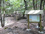 Information board at the burgstall
 -
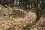 Area of the entrance on the western side of the site


References
Literature
- Historischer Verein für Oberfranken: Jahresbericht der Jahre 1846/47; Beschreibung einer Begehung der Ringwallanlage am Schlosshügel durch eine Kommission des Vereins im Jahre 1843.
- Joachim Kröll: Geschichte des Marktes Weidenberg. Verlag Marktgemeinde Weidenberg, Gesamtherstellung Julius Steeger & Co. GmbH, Bayreuth, 1967.
- Hermann Kerscher (Landesamt für Denkmalpflege): Zweihundert Jahre topografische Denkmalvermessung in Bayern. Anmerkungen zu frühen archäologisch-topographischen Plänen des Ruinenkartographen Johann Christoph Stierlein, Archäologisches Jahr Bayern, Stuttgart, 1989.
- Rüdiger Bauriedel, Ruprecht Konrad-Röder: Mittelalterliche Befestigungen und niederadelige Ansitze im Landkreis Bayreuth. Ellwanger Druck und Verlag, Bayreuth, 2007, ISBN 978-3-925361-63-0, pp. 98 and 104.
- Werner Schamel: Geheimnisse des Schlosshügels, In: "Seinerzeit…". Heimatkundliche Serie im Amtlichen Mitteilungsblatt der Verwaltungsgemeinschaft Weidenberg Nummer 14, 30 September 2008.