
Stowe, Vermont
Stowe, Vermont | |
|---|---|
 Stowe Town Hall, on Main Street | |
 Seal | |
| Nickname: The Ski Capital of the East | |
 Stowe, Vermont | |
 Stowe, Vermont Location in the United States | |
| Coordinates: 44°28′31″N 72°42′8″W / 44.47528°N 72.70222°W | |
| Country | United States |
| State | Vermont |
| County | Lamoille |
| Government | |
| • Type | Board of Selectmen |
| Area | |
| • Total | 72.7 sq mi (188.4 km2) |
| • Land | 72.7 sq mi (188.2 km2) |
| • Water | 0.1 sq mi (0.2 km2) |
| Elevation | 968 ft (295 m) |
| Population (2010) | |
| • Total | 4,314 |
| • Density | 59.7/sq mi (23.1/km2) |
| Time zone | UTC-5 (Eastern (EST)) |
| • Summer (DST) | UTC-4 (EDT) |
| ZIP code | 05672 |
| Area code | 802 Exchange: 253 |
| FIPS code | 50-70525[1] |
| GNIS feature ID | 1462219[2] |
Stowe is a town in Lamoille County, Vermont, United States. The population was 4,314 at the 2010 census.
History
Stowe was chartered June 8, 1763 by Royal Governor Benning Wentworth of the New Hampshire colony.[3]
Geography
According to the United States Census Bureau, the town has a total area of 72.7 square miles (188.4 km2), of which 72.7 square miles (188.2 km2) is land and 0.1 square mile (0.2 km2) (0.10%) is water. By area, it is the second-largest town in the state of Vermont after Chittenden in Rutland County.

Stowe lies in a broad, fertile valley between Mount Mansfield and other peaks of the Green Mountains to the west, and the Worcester Range to the east. The Little River with its main east and west branches and various tributaries, flows southward and, above Waterbury Center, empties into the large reservoir created by the flood control dam. From there the Little River flows southward and eventually empties into the westward flowing Winooski River west of the Village of Waterbury.[citation needed]
Demographics
| Census | Pop. | Note | %± |
|---|---|---|---|
| 1800 | 316 | — | |
| 1810 | 650 | 105.7% | |
| 1820 | 957 | 47.2% | |
| 1830 | 1,570 | 64.1% | |
| 1840 | 1,371 | −12.7% | |
| 1850 | 1,771 | 29.2% | |
| 1860 | 2,046 | 15.5% | |
| 1870 | 2,049 | 0.1% | |
| 1880 | 1,896 | −7.5% | |
| 1890 | 1,886 | −0.5% | |
| 1900 | 1,926 | 2.1% | |
| 1910 | 1,991 | 3.4% | |
| 1920 | 1,800 | −9.6% | |
| 1930 | 1,654 | −8.1% | |
| 1940 | 1,741 | 5.3% | |
| 1950 | 1,720 | −1.2% | |
| 1960 | 1,901 | 10.5% | |
| 1970 | 2,388 | 25.6% | |
| 1980 | 2,991 | 25.3% | |
| 1990 | 3,433 | 14.8% | |
| 2000 | 4,339 | 26.4% | |
| 2010 | 4,314 | −0.6% | |
| 2014 (est.) | 4,411 | [4] | 2.2% |
| U.S. Decennial Census[5] | |||
As of the census[1] of 2000, there were 4,339 people, 1,905 households, and 1,129 families residing in the town. The population density was 59.7 people per square mile (23.1/km2). There were 2,728 housing units at an average density of 37.5 per square mile (14.5/km2). The racial makeup of the town was 97.51% White, 0.28% African American, 0.37% Native American, 0.44% Asian, 0.23% from other races, and 1.18% from two or more races. Hispanic or Latino of any race were 1.06% of the population.
There were 1,905 households out of which 26.1% had children under the age of 18 living with them, 50.0% were married couples living together, 6.4% had a female householder with no husband present, and 40.7% were non-families. 29.0% of all households were made up of individuals and 8.9% had someone living alone who was 65 years of age or older. The average household size was 2.27 and the average family size was 2.83.
In the town, the population was spread out with 21.1% under the age of 18, 6.9% from 18 to 24, 28.3% from 25 to 44, 30.3% from 45 to 64, and 13.5% who were 65 years of age or older. The median age was 41 years. For every 100 females there were 103.6 males. For every 100 females age 18 and over, there were 101.2 males.
Climate
| Climate data for Stowe, Vermont (1981 – 2010 averages). Elevation 795 ft (242 m). | |||||||||||||
|---|---|---|---|---|---|---|---|---|---|---|---|---|---|
| Month | Jan | Feb | Mar | Apr | May | Jun | Jul | Aug | Sep | Oct | Nov | Dec | Year |
| Mean daily maximum °F (°C) | 26.1 (−3.3) |
29.8 (−1.2) |
38.8 (3.8) |
52.8 (11.6) |
65.7 (18.7) |
74.3 (23.5) |
78.7 (25.9) |
77.2 (25.1) |
69.0 (20.6) |
55.9 (13.3) |
43.6 (6.4) |
31.1 (−0.5) |
53.6 (12.0) |
| Mean daily minimum °F (°C) | 5.6 (−14.7) |
7.5 (−13.6) |
17.2 (−8.2) |
30.7 (−0.7) |
41.3 (5.2) |
51.3 (10.7) |
55.7 (13.2) |
53.9 (12.2) |
46.1 (7.8) |
35.2 (1.8) |
26.6 (−3.0) |
13.7 (−10.2) |
32.1 (0.1) |
| Average precipitation inches (mm) | 2.67 (68) |
2.42 (61) |
2.86 (73) |
3.18 (81) |
3.83 (97) |
4.11 (104) |
4.45 (113) |
4.46 (113) |
3.51 (89) |
4.39 (112) |
3.61 (92) |
3.24 (82) |
42.73 (1,085) |
| Source: PRISM [6] | |||||||||||||
Economy
This section needs additional citations for verification. (June 2010) |
There has been some manufacturing in Stowe, such as the Tubbs Snowshoe factory, but they closed in 2009 and moved their manufacturing overseas.[citation needed]
Personal income
The median income for a household in the town was $52,378, and the median income for a family was $64,700. Males had a median income of $37,788 versus $31,689 for females. The per capita income for the town was $35,474. About 3.7% of families and 6.8% of the population were below the poverty line, including 6.8% of those under age 18 and 5.3% of those age 65 or over.[1] The median house value was $412,183 in 2012.[7]
Tourism
Stowe is host to arts and crafts shows, a balloon festival, and many other special events. The weekend-long British Invasion event is held annually in Stowe during the third week of September. The Stowe Theater Guild, along with Hyde Park Opera House, and the Waterbury Festival Players, offer theatrical productions each summer.
The 2007 Fed Cup Semifinals between the United States team (coached by Zina Garrison) and Russia took place in Stowe on hard courts in July. Vania King, Lisa Raymond, Meilen Tu and Venus Williams made up the team for the U.S. A 4100-seat stadium was built at Topnotch Resort.[8]
Points of interest
- Trapp Family Lodge[citation needed]
- Vermont Ski and Snowboard Museum[citation needed]
- Stowe Mountain Resort[citation needed]
Other activities
The Pinnacle hiking trail is located in Stowe Hollow off Upper Hollow Road.[citation needed]
In 2012, Stowe Land Trust conserved the Cady Hill Forest property in the heart of Stowe Village, and transferred ownership to the Town of Stowe. Cady Hill offers more than 11 miles (18 km) of hiking and mountain bike trails, with an access point off of Route 108 (Mountain Road). The Stowe Mountain Bike Club is currently responsible for maintaining the trail network.[9]
Stowe Recreation Path
The Stowe Recreation Path is a recreation trail[10] that runs 5.3 miles (8.5 km), and was completed in 1989 at a total cost of $680,000. The Stowe Recreation Path has received several awards and honors.[11]
Education
There are three public schools in town: Stowe Elementary School, Stowe Middle School, and Stowe High School.

Stowe Land Trust
Stowe Land Trust has conserved 30 properties and over 3,500 acres (14 km2), many of which are available to the public. One is Wiessner Woods, conserved by the trust in 1992 through a donation from the Wiessner family.[12]
Media
The Stowe Reporter, covering local politics, business, arts and personalities, has been the weekly newspaper of record for the town of Stowe since its founding in 1958. Radio station WCVT; is licensed to Stowe, and programs a classical music format.
HGTV's 2011 Dream Home is located in Stowe.[13]
Infrastructure
Roads
 Vermont Route 108, locally known as Mountain Road
Notable people
- Jake Burton Carpenter, CEO of Burton Snowboards[citation needed]
- Rusty DeWees, comedian, actor, and writer
- Joseph Dutton, worked as a missionary with Father Damien
- William "Billy" Kidd, first American man to earn an Olympic medal in alpine skiing
- Joe Kirkwood, Sr., golfer
- Graham Mink, former right wing for the Washington Capitals, now playing for Dornbirner EC of the Austrian Hockey League (EBEL)
- Joseph Skinger, artisan
- Ken Squier, Lap-by-Lap commentator for NASCAR
- Maria von Trapp, matriarch of the Trapp Family Singers
- Ty Walker, youngest member of the 2014 US Olympic Slopestyle Snowboard team
- Fritz Wiessner, pioneer of free climbing
Gallery
-
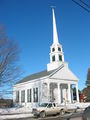 Stowe Community Church
 -
 Opposite the Town Hall is Shaw's General Store
 -
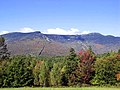 Stowe's main ski resort is located on Mount Mansfield.


References
- ^ a b c "American FactFinder". United States Census Bureau. Retrieved 2008-01-31.
- ^ "US Board on Geographic Names". United States Geological Survey. 2007-10-25. Retrieved 2008-01-31.
- ^ History of Stowe Vermont to 1869 by Mrs. M.N. Wilkins, As originally published in THE VERMONT HISTORICAL GAZATEER, a Magazine Embracing a History of Each Town Civil, Ecclesiastical, Biographicl and Military. Vol.II (Burlington, VT 1871) Edited and Published by Miss A. M Hemenway: Stowe Historical Society Stowe Vermont 1987
- ^ "Annual Estimates of the Resident Population for Incorporated Places: April 1, 2010 to July 1, 2014". Retrieved June 4, 2015.
- ^ "U.S. Decennial Census". United States Census Bureau. Retrieved June 18, 2015.
- ^ http://prism.oregonstate.edu/explorer PRISM. Accessed May 24, 2017
- ^ "Stowe, Vermont (VT 05672) profile: population, maps, real estate, averages, homes, statistics, relocation, travel, jobs, hospitals, schools, crime, moving, houses, news, sex offenders".
- ^ "Official site for the Fed Cup in Stowe". Fedcupstowe.com. Retrieved 2012-04-17.
- ^ http://www.stowemtnbike.com/page-1670388
- ^ Map of Path, SuperPages.com
- ^ "History of the Stowe Recreation Path", Town of Stowe
- ^ "Wiessner Woods". Stowe Land Trust. Retrieved 2012-04-17.
- ^ "HGTV". HGTV. Retrieved 2012-04-17.
External links
 Stowe travel guide from Wikivoyage
 Media related to Stowe, Vermont at Wikimedia Commons
- Official website
Municipalities and communities of Lamoille County, Vermont, United States | ||
|---|---|---|
| Towns | ||
| Villages | ||
| CDPs | ||
| Other communities | ||
| International | |
|---|---|
| National | |
| Other | |