Guasimal, Sancti Spíritus
Appearance
Guasimal | |
|---|---|
Village (consejo popular) | |
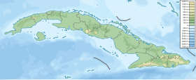
Location of Guasimal in Cuba | |
| Coordinates: 21°44′N 79°27′W / 21.733°N 79.450°W | |
| Country | |
| Province | Sancti Spíritus |
| Municipality | Sancti Spíritus |
| Population | |
| • Total | 5,000 |
| Time zone | UTC-5 (EST) |
| Area code | +53-41 |
Guasimal is a village (consejo popular) of the municipality of Sancti Spíritus, Sancti Spíritus Province, Cuba. The town has a population of 5,000 people. Che Guevara established his first guerrilla camp near the town.[1]
Aero Caribbean Flight 883 crashed near Guasimal in November 2010.
References
- ^ Guasimal desanda la memoria Archived 2008-09-22 at the Wayback Machine

