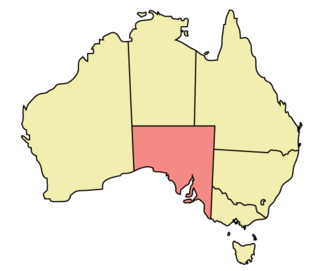
Geography of South Australia
Appearance
 | |
| Continent | Australia |
|---|---|
| Coordinates | 30°S 135°E / 30°S 135°E |
| Area | Ranked 4th among states and territories |
| • Total | 1,043,514 km2 (402,903 sq mi) |
| Coastline | 3,816 km (2,371 mi) |
| Borders | Land borders: Western Australia, Northern Territory, Queensland, New South Wales, Victoria |
| Highest point | Mount Woodroffe 1,435 m (4,708 ft) |
| Lowest point | Lake Eyre -15 m (49 ft) |
| Longest river | Murray River 683 km (424 mi) |
| Largest lake | Lake Eyre 9690 km² |
