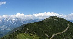
Hauser Kaibling
Appearance
| Hauser Kaibling | |
|---|---|
 | |
| Location | Austria |
| Top elevation | 2,015 meters (6,611 ft) |
| Base elevation | 752 meters (2,467 ft) |
| Skiable area | 167 Piste Kilometers |
| Lift system | 0 total (0 Cable Car, 0 Double Seat chairlift, 0 Tow Lifts) |
| Terrain parks | 1, Atomic Superpark |
| Website | http://www.planai.at/winter/index.php |
Hauser Kaibling is a ski area located within the Planai ski area.
47°22′25″N 13°46′43″E / 47.3736°N 13.7786°E
