Finote Selam
Finote Selam | |
|---|---|
| Coordinates: 10°42′00″N 37°16′00″E / 10.70000°N 37.26667°E | |
| Country | Ethiopia |
| Region | Amhara Region |
| Zone | Mirab Gojjam Zone |
| Elevation | 1,917 m (6,289 ft) |
| Population (2007) | |
| • Total | 105,913 |
| Time zone | UTC+3 (EAT) |
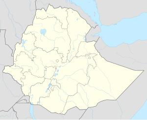
Finote Selam is a town and separate woreda in western Ethiopia. Located in the Mirab Gojjam Zone of the Amhara Region. Finote Selam, the "Pacific Road", the name given by Emperor Haile Silassie during Italian attacked Ethiopia. Formerly its name was Wojet. Now Finote Selam is the capital city of West Gojjam Zone. This town has a longitude and latitude of 10°42′N 37°16′E / 10.700°N 37.267°E with an elevation of 1917 meters above sea level. It is surrounded by Jabi Tehnan woreda.
In 1964, a hospital for lepers had been built in Finote Selam by the private fund "Swedish Aid to Leprous Children in Ethiopia". Two years later, it had still not been put into use.[1]
Based on the 2007 national census conducted by the Central Statistical Agency of Ethiopia (CSA), this town has a total population of 25,913, of whom 13,035 are men and 12,878 women. The majority of the inhabitants practiced Ethiopian Orthodox Christianity, with 95.91% reporting that as their religion, while 3.34% were Muslim.[2] The 1994 census reported this town had a total population of 13,834 of whom 6,350 were males and 7,484 were females.
People
The leading scientist Segenet Kelemu was born here.[3]
Notes
- ^ "Local History in Ethiopia"[permanent dead link] The Nordic Africa Institute website (accessed 27 November 2007)
- ^ Census 2007 Tables: Amhara Region Archived November 14, 2010, at the Wayback Machine, Tables 2.1, 2.4, 2.5, 3.1, 3.2 and 3.4.
- ^ "Interview with the Boss - BecA-ILRI hub". hub.africabiosciences.org. Retrieved 2017-09-30.
Template:Woredas of the Mirab Gojjam Zone

