Jump to content

Bald Knob (Missouri)

Coordinates: 37°39′25″N 90°30′51″W / 37.6569958°N 90.5142889°W / 37.6569958; -90.5142889
From Wikipedia, the free encyclopedia

This is the current revision of this page, as edited by Melofors (talk | contribs) at 09:11, 27 January 2019. The present address (URL) is a permanent link to this version.

(diff) ← Previous revision | Latest revision (diff) | Newer revision → (diff)
Bald Knob
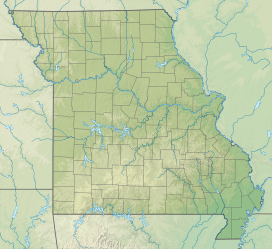
Bald Knob is located in Missouri
Bald Knob
Bald Knob
Bald Knob is located in the United States
Bald Knob
Bald Knob
Bald Knob (the United States)
Highest point
Elevation480 m (1,570 ft)[1]
Prominence29 m (95 ft)[1]
Isolation0.87 km (0.54 mi)[1]
Coordinates37°42′53″N 90°42′34″W / 37.71477°N 90.709333°W / 37.71477; -90.709333[1]
Geography
LocationMissouri
Parent rangeSt. Francois Mountains

Bald Knob is a summit in St. Francois County, Missouri, United States.[1] It has an elevation of 1,574 feet (480 m), and was named after its treeless peak.[2]

References

[edit]
  1. ^ a b c d e "Bald Knob".
  2. ^ Zimmer, Gertude Minnie. Place Names Of Five Southeast Counties Of Missouri. University of Missouri--Columbia, 1944.

37°39′25″N 90°30′51″W / 37.6569958°N 90.5142889°W / 37.6569958; -90.5142889