
Search results
The page "International marine satellite" does not exist. You can create a draft and submit it for review or request that a redirect be created, but consider checking the search results below to see whether the topic is already covered.
 Ranger took 63 digital photographs which were sent by International Marine Satellite to the Navy Office of Information within hours of being taken. This...48 KB (5,209 words) - 09:05, 30 August 2024
- Look up satellite in Wiktionary, the free dictionary. Look up branch in Wiktionary, the free dictionary. A satellite campus, branch campus or regional...21 KB (2,228 words) - 07:59, 9 June 2024
 training installations, as well as satellite facilities. Marine Corps bases are concentrated around the locations of the Marine Expeditionary Forces, though...182 KB (17,209 words) - 21:09, 15 September 2024
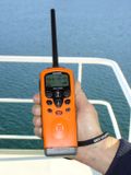 good reception. For longer range communication at sea, marine MF and marine HF bands and satellite phones can be used. Half-duplex channels here are listed...45 KB (2,504 words) - 17:20, 4 September 2024
 The International Cospas-Sarsat Programme is a satellite-aided search and rescue (SAR) initiative. It is organized as a treaty-based, nonprofit, intergovernmental...43 KB (4,726 words) - 13:18, 9 September 2024
- Facilities of the United States Marine Corps. Marine Corps Installations Command Marine Corps Installations East Marine Corps Installations West List of...29 KB (231 words) - 09:52, 30 August 2024
 A weather satellite or meteorological satellite is a type of Earth observation satellite that is primarily used to monitor the weather and climate of the...30 KB (3,460 words) - 13:25, 29 July 2024
 EUMETSAT (redirect from European Meteorological Satellite Organisation)Exploitation of Meteorological Satellites (EUMETSAT) is an intergovernmental organisation created through an international convention agreed by a current...21 KB (1,484 words) - 07:21, 1 September 2024
 services (VTS). When satellites are used to receive AIS signatures, the term Satellite-AIS (S-AIS) is used. AIS information supplements marine radar, which continues...89 KB (11,143 words) - 16:35, 17 August 2024
- Marine electronics devices include chartplotter, marine VHF radio, autopilot and self-steering gear, fishfinder and sonar, marine radar, satellite navigation...6 KB (501 words) - 06:29, 5 September 2024
- Copernicus Programme (redirect from Sentinel (satellite))atmosphere, marine, land, climate, emergency and security. Copernicus builds upon three components: The space component (observation satellites and associated...42 KB (4,701 words) - 05:32, 9 September 2024
 Geospatial intelligence (redirect from Satellite intelligence)imagery and mapping data, whether collected by commercial satellite, government satellite, aircraft (such as Unmanned Aerial Vehicles [UAV] or reconnaissance...20 KB (2,158 words) - 23:37, 30 May 2024
 also protecting marine life. Pop-up satellite archival tag (PSAT or PAT) plays a vital role in marine conservation by providing marine biologists with...63 KB (7,159 words) - 04:25, 8 July 2024
 Maritime transport (redirect from Marine transport)Merchant Marine, a chief steward must have a Merchant Mariner's Document issued by the United States Coast Guard. Because of international law, conventions...37 KB (3,077 words) - 00:52, 5 August 2024
 observation satellites are Earth-orbiting spacecraft with sensors used to collect imagery and measurements of the surface of the earth. These satellites are used...38 KB (1,190 words) - 04:45, 1 July 2024
- tonnage and International Maritime Organisation (IMO) number. Users can submit photographs of the vessels which other users can rate. The basic MarineTraffic...6 KB (453 words) - 22:32, 4 August 2024
 SRT Marine System Solutions Thrane & Thrane vTrack VMS MetOcean Telematics iTrac VMS GMV VMS units principally rely on global navigation satellite systems...63 KB (7,805 words) - 16:37, 23 May 2024
 In the deep ocean, marine snow (also known as "ocean dandruff") is a continuous shower of mostly organic detritus falling from the upper layers of the...22 KB (2,737 words) - 21:03, 24 June 2024
- Marine Conservation Institute (formerly Marine Conservation Biology Institute) is a tax-exempt nonprofit ocean conservation organization working to identify...16 KB (1,604 words) - 04:18, 1 June 2024
 Marine Mind, which took up monitoring Hvaldimir in Rogaland. Marine Mind's focus was on educating the public about Hvaldimir while promoting marine stewardship...32 KB (3,492 words) - 21:41, 13 September 2024


- Navigation Satellite System (2016) State Council Information Office of the People's Republic of China 4301412China's BeiDou Navigation Satellite System2016State
- James Norman Mattis (born 8 September 1950) is a retired United States Marine Corps general who was the 26th United States Secretary of Defense, serving
- Most people underestimate the impact of satellites on their daily lives. Satellites are used in telecommunications, television, radio, weather-tracking