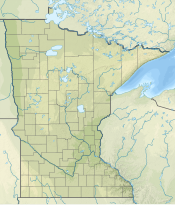
Disappointment Mountain
| Disappointment Mountain | |
|---|---|
| Highest point | |
| Elevation | 1,814 ft (553 m)[1] |
| Coordinates | 47°59′42″N 91°19′50″W / 47.99500°N 91.33056°W[1] |
| Geography | |
| Location | Fall Lake Township, Lake County, Minnesota, U.S. |
| Parent range | Sawtooth Mountains |
Disappointment Mountain, also sometimes called Disappointment Hill, is a peak in northeastern Minnesota. It is located about a mile east of the lake which shares its name.[2]
References[edit]
- ^ a b "Disappointment Mountain". Geographic Names Information System. United States Geological Survey, United States Department of the Interior. Retrieved 2009-02-07.
- ^ Upham, Warren (2001). Minnesota Place Names, A Geographical Encyclopedia (Third ed.). MHS Press. p. 316. ISBN 0-87351-396-7.

