
File:EU-Spain.svg

Size of this PNG preview of this SVG file: 713 × 600 pixels. Other resolutions: 285 × 240 pixels | 571 × 480 pixels | 913 × 768 pixels | 1,218 × 1,024 pixels | 2,435 × 2,048 pixels | 2,045 × 1,720 pixels.
Original file (SVG file, nominally 2,045 × 1,720 pixels, file size: 7.31 MB)
| This is a file from the Wikimedia Commons. Information from its description page there is shown below. Commons is a freely licensed media file repository. You can help. |
Summary
| Description |
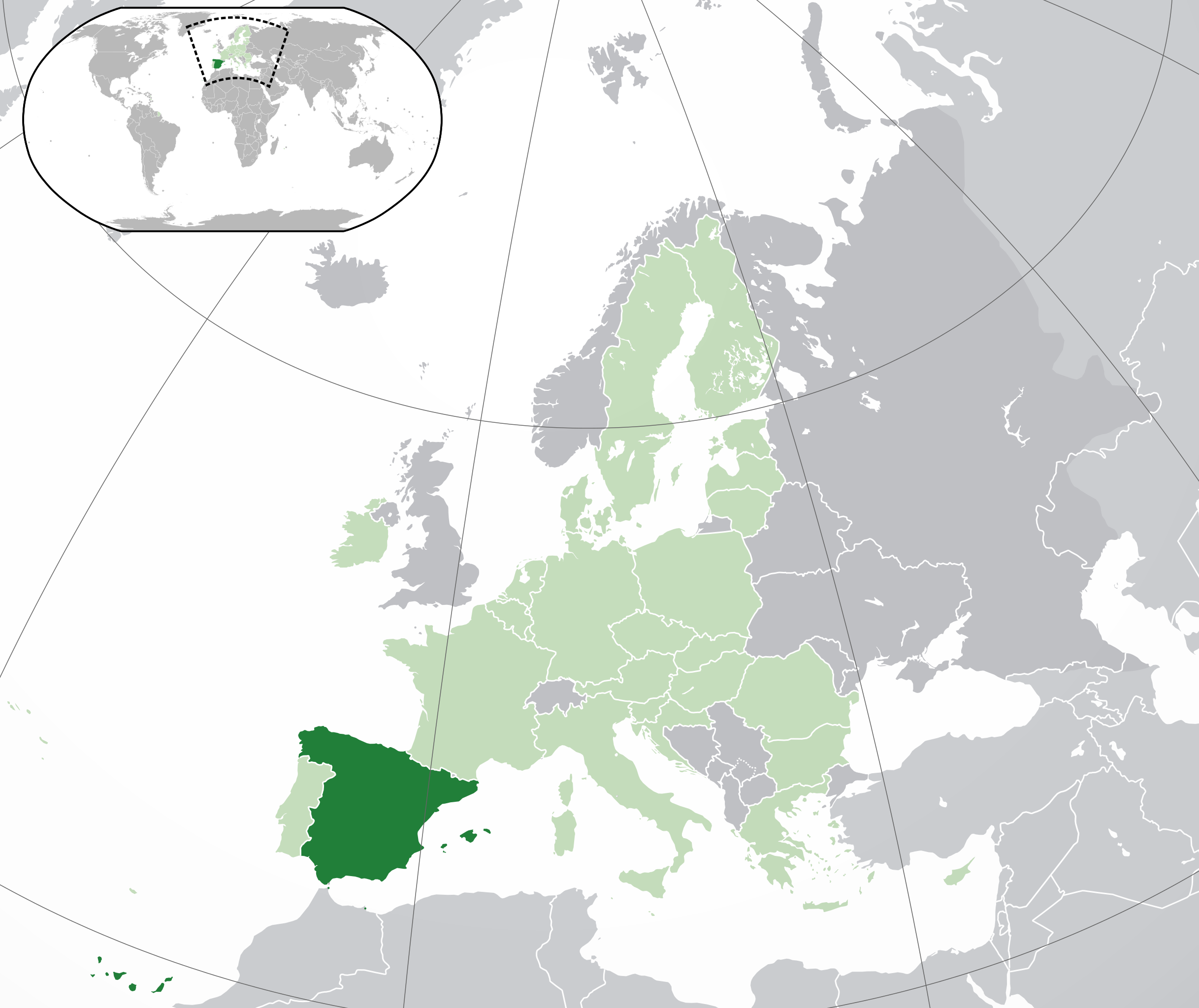
English: (Dark-Green) Spain. (Light-Green) The rest of the European Union (EU). (Dark-gray) The rest of Europe. (Light-gray) The surrounding region.
See also: |
| SVG development | |
| Date | |
| Source |
This vector image includes elements that have been taken or adapted from this file: |
| Author | NuclearVacuum |
| Other versions |
.svg)
Licensing
I, the copyright holder of this work, hereby publish it under the following licenses:
This file is licensed under the Creative Commons Attribution-Share Alike 3.0 Unported license.
- You are free:
- to share – to copy, distribute and transmit the work
- to remix – to adapt the work
- Under the following conditions:
- attribution – You must give appropriate credit, provide a link to the license, and indicate if changes were made. You may do so in any reasonable manner, but not in any way that suggests the licensor endorses you or your use.
- share alike – If you remix, transform, or build upon the material, you must distribute your contributions under the same or compatible license as the original.

|
Permission is granted to copy, distribute and/or modify this document under the terms of the GNU Free Documentation License, Version 1.2 or any later version published by the Free Software Foundation; with no Invariant Sections, no Front-Cover Texts, and no Back-Cover Texts. A copy of the license is included in the section entitled GNU Free Documentation License. |
You may select the license of your choice.
File history
Click on a date/time to view the file as it appeared at that time.
| Date/Time | Thumbnail | Dimensions | User | Comment | |
|---|---|---|---|---|---|
| current | 17:35, 27 February 2023 | | 2,045 × 1,720 (7.31 MB) | Thom.lanaud | + Ceuta and Melilla |
| 02:32, 1 February 2020 |  | 2,045 × 1,720 (7.31 MB) | Thom.lanaud | Minus the UK + the Channel Islands and Isle of Man, which were never part of the EU | |
| 15:00, 29 October 2017 |  | 2,045 × 1,720 (7.32 MB) | Garam | Reverted to version as of 20:38, 28 October 2017 (UTC): other version; see Commons:Overwriting existing files. | |
| 10:59, 29 October 2017 |  | 2,045 × 1,720 (7.35 MB) | Finley jones | Reverted to version as of 20:22, 28 October 2017 (UTC) Issue does not regard recognition, but disputed status. Talk:Spain discussion did not agree that Catalonia was not disputed territory, whereas the consensus has been that it is, in fact, disputed t... | |
| 20:38, 28 October 2017 |  | 2,045 × 1,720 (7.32 MB) | Brgesto | Reverted to version as of 09:12, 28 October 2017 (UTC) Unconstitutional proclamation and not recognized by any EuroZone country | |
| 20:22, 28 October 2017 |  | 2,045 × 1,720 (7.35 MB) | Viseman | Reverted to version as of 22:34, 27 October 2017 (UTC) - Territory is disputed by the Generalitat de Catalunya | |
| 09:12, 28 October 2017 |  | 2,045 × 1,720 (7.32 MB) | Durero | Reverted to version as of 20:36, 25 October 2016 (UTC) - No one has recognized this fact, there is no disputed territory | |
| 22:34, 27 October 2017 |  | 2,045 × 1,720 (7.35 MB) | Finley jones | Reverted to version as of 22:25, 27 October 2017 (UTC) | |
| 22:30, 27 October 2017 |  | 2,045 × 1,720 (7.35 MB) | Finley jones | (not sure why changes didn't upload on last file, showed up fine on preview) Added disputed region (Catalonia) | |
| 22:25, 27 October 2017 |  | 2,045 × 1,720 (7.35 MB) | Finley jones | Added disputed regions (Catalonia) | |
| 20:36, 25 October 2016 |  | 2,045 × 1,720 (7.32 MB) | Giorgi Balakhadze | Rv of sockpuppet and per COM:OVERWRITE | |
| 10:34, 15 February 2016 |  | 2,045 × 1,720 (7.38 MB) | Rob984 | Reverted to version as of 15:58, 18 March 2015 (UTC) | |
| 04:05, 23 July 2015 |  | 2,045 × 1,720 (2.6 MB) | Polyethylen | Reverted to version as of 18:41, 28 March 2015 | |
| 23:22, 22 July 2015 |  | 811 × 467 (832 KB) | Viet-hoian1 | More precise location | |
| 23:14, 22 July 2015 |  | 1,024 × 728 (1,019 KB) | Viet-hoian1 | Including Canary Islands, Ceuta and Melilla and other corrections. | |
| 18:41, 28 March 2015 |  | 2,045 × 1,720 (2.6 MB) | Avala | stop the edit war please | |
| 15:58, 18 March 2015 |  | 2,045 × 1,720 (7.38 MB) | Mapclean | Reverted to Leftcry's version, please go to your talk page | |
| 14:11, 21 February 2015 |  | 2,045 × 1,720 (2.6 MB) | VS6507 | Spain. Greece. Slovakia. Cyprus. Romania VETO | |
| 19:34, 16 November 2014 |  | 2,045 × 1,720 (7.38 MB) | Leftcry | Reverted to version as of 15:43, 6 August 2014 Please go to your talk page | |
| 16:38, 16 November 2014 |  | 2,045 × 1,720 (2.6 MB) | A2D2 | The map must show the original de-jure status with no breakaway regions, as it was originally created. An alternative map showing the de-facto status with breakaway regions needs to be created instead. | |
| 15:43, 6 August 2014 |  | 2,045 × 1,720 (7.38 MB) | Rob984 | Improved version: More accurate coastline, borders, etc. Added Gradient and Longitude and latitude lines. Sudan border. | |
| 09:45, 1 July 2013 |  | 2,045 × 1,720 (2.6 MB) | U5K0 | croatia | |
| 16:28, 3 May 2013 |  | 2,045 × 1,720 (2.59 MB) | Chipmunkdavis | Reverted to version as of 10:56, 23 March 2010. Countries are different colours, borders were shifted, pngs coming up weird | |
| 15:00, 3 May 2013 |  | 2,045 × 1,720 (287 KB) | Perhelion | opt: unnecessary accuracy removed | |
| 10:56, 23 March 2010 |  | 2,045 × 1,720 (2.59 MB) | Miguillen | es:Madeira no es de España. Soluciono error / en:Madeira is not Spain. Fix error | |
| 14:57, 23 October 2009 |  | 2,045 × 1,720 (2.59 MB) | NuclearVacuum | consensus version | |
| 18:35, 18 October 2009 |  | 2,045 × 1,720 (2.62 MB) | NuclearVacuum | final version | |
| 17:53, 17 October 2009 |  | 680 × 520 (530 KB) | NuclearVacuum | new version | |
| 05:10, 17 October 2009 |  | 680 × 520 (526 KB) | NuclearVacuum | red coloring | |
| 16:53, 16 October 2009 |  | 680 × 520 (526 KB) | NuclearVacuum | {{Information |Description={{en|1={{EU-SVG-en|Spain}}}} |Source=*File:Blank map europe.svg<br>{{Inkscape}} |Author=NuclearVacuum |Date=2009-10 |Permission= |other_versions=*File:Location Spain EU Europe.png }} [[Category: |
File usage
The following pages on the English Wikipedia use this file (pages on other projects are not listed):
- Euro gold and silver commemorative coins
- Euro gold and silver commemorative coins (Spain)
- Intersex rights in Spain
- LGBT rights in Spain
- List of companies of Spain
- List of sovereign states and dependent territories in Europe
- Spain
- Talk:England/Archive 8
- User:Alcismo/Spain
- User:Ariadna.rodriguez12/sandbox/Infobox/Country
- User:Belen.ilarduya/sandbox/Infobox/Country
- User:Eetutus/sandbox
- User:LuisGomez111/Spain
- User:Maru Alava/sandbox/Templates
- User:Rob984/Locator maps of countries in Europe
- User:Truthspeakerknows/sandbox
- User:Victoriaaguirre/sandbox/Infobox/Country
Global file usage
The following other wikis use this file:
- Usage on ace.wikipedia.org
- Usage on ady.wikipedia.org
- Usage on af.wikipedia.org
- Usage on als.wikipedia.org
- Usage on ami.wikipedia.org
- Usage on am.wikipedia.org
- Usage on an.wikipedia.org
- Usage on ar.wikipedia.org
- بوابة:إسبانيا
- بوابة:إسبانيا/مقدمة
- بوابة:إسبانيا/افتتاحية
- مستخدم:ElWaliElAlaoui/ملعب 8
- مستخدم:Sayfe dine
- معاملة المثليين في إسبانيا
- مستخدم:جار الله/قائمة صور مقالات العلاقات الثنائية
- العلاقات الأنغولية الإسبانية
- العلاقات الإسبانية الكورية الجنوبية
- العلاقات الإريترية الإسبانية
- العلاقات الإسبانية السويسرية
- العلاقات الألمانية الإسبانية
- العلاقات الإسبانية الليختنشتانية
- العلاقات الإسبانية البوليفية
- العلاقات الإسبانية الموزمبيقية
- العلاقات الألبانية الإسبانية
- العلاقات الإسبانية البلجيكية
- العلاقات الإثيوبية الإسبانية
- العلاقات الإسبانية البيلاروسية
- العلاقات الإسبانية الطاجيكية
- العلاقات الإسبانية الرومانية
- العلاقات الأرجنتينية الإسبانية
- العلاقات الإسبانية الغامبية
- العلاقات الإسبانية القبرصية
- العلاقات الإسبانية السيراليونية
- العلاقات الإسبانية النيبالية
- العلاقات الإسبانية الليبيرية
- العلاقات التشيكية الإسبانية
- العلاقات الإسبانية الميانمارية
- العلاقات الإسبانية الكندية
- العلاقات الإسبانية الزيمبابوية
- العلاقات الإسبانية الإسرائيلية
- العلاقات الإسبانية البالاوية
- العلاقات الإسبانية المالية
- العلاقات الإسبانية النيجيرية
- العلاقات اليمنية الإسبانية
- العلاقات الإسبانية الفانواتية
- العلاقات الغابونية الإسبانية
- العلاقات الإسبانية البنمية
- العلاقات الإسبانية الكوبية
- العلاقات الإسبانية الجورجية
- العلاقات الإسبانية التونسية
- العلاقات الإسبانية الكورية الشمالية
View more global usage of this file.