Maverick Canyon (Nevada)
| Maverick Canyon | |
|---|---|
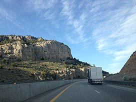
 View east along Interstate 80 as it ascends Maverick Canyon towards Pequop Summit | |
| Floor elevation | 5,738 feet (1,700 m) at the mouth |
| Geography | |
| Coordinates | 41°03′59″N 114°36′20″W / 41.066525°N 114.605469°W |
Maverick Canyon is a steep-sided canyon in the Pequop Mountains of Elko County, Nevada, United States.[1] Interstate 80 traverses the canyon as it ascends the Pequop Mountains from the west.
References[edit]
Wikimedia Commons has media related to Maverick Canyon (Nevada).

