Úlibice
Appearance
Úlibice | |
|---|---|
Municipality and village | |
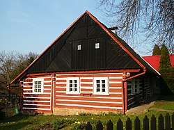
 Typical log house (no.16) | |
| Coordinates: 50°26′N 15°26′E / 50.433°N 15.433°E | |
| Country | |
| Region | Hradec Králové Region |
| District | Jičín District |
| Area | |
| • Total | 260 sq mi (674 km2) |
| Population (2006) | |
| • Total | 233 |
| Time zone | UTC+1 (CET) |
| • Summer (DST) | UTC+2 (CEST) |
| ZIP code | 50707 |
Úlibice is a village and municipality in Jičín District in the Hradec Králové Region of the Czech Republic. The municipality covers an area of 6,74 km² and as of 2006 it had a population of 233.
Wikimedia Commons has media related to Úlibice.


