Čierna voda
Appearance
| Čierna voda | |
|---|---|
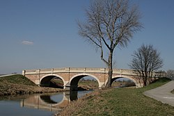
 Bridge near Kráľová pri Senci | |
 | |
| Physical characteristics | |
| Source | |
| • location | Little Carpathians |
| Mouth | |
• location | Little Danube |
| Length | 106 km (66 mi) |
| Basin features | |
| Progression | Little Danube→ Váh→ Danube→ Black Sea |
| Tributaries | |
| • left | Dudváh |
The Čierna voda is a lowland river in western Slovakia. It is 106 km long. Its source is in the Little Carpathians, near the town Svätý Jur. Near the town Čierna Voda, it is joined by its largest tributary: the Dudváh. It discharges into the Little Danube river near the village Dolný Chotár.
