1951 Atlantic hurricane season
| 1951 Atlantic hurricane season | |
|---|---|
| Seasonal boundaries | |
| First system formed | {{{First storm formed}}} |
| Last system dissipated | {{{Last storm dissipated}}} |
| Seasonal statistics | |
| Total fatalities | Unknown |
| Total damage | Unknown |
The 1951 Atlantic hurricane season officially began on June 15, 1951,[1] and lasted until November 15, 1951.[2] These dates conventionally delimit the period of each year when most tropical cyclones form in the Atlantic basin. The 1951 season was a fairly active one. Like the 1950 season, names from the Joint Army/Navy Phonetic Alphabet were used to name storms this season.
The most notable storm of the season was Hurricane Charlie, which struck the Mexican island of Cozumel as a Category 4 hurricane on the Saffir–Simpson Hurricane Scale, causing heavy damage. Another notable storm was Hurricane Able, which was the earliest recorded major hurricane in Atlantic hurricane history.
Storms
Hurricane Able
| Category 3 hurricane (SSHWS) | |
| Duration | May 21 – May 24 |
|---|---|
| Peak intensity | 115 mph (185 km/h) (1-min); 980 mbar (hPa) |
A cold-core upper level low over the western Atlantic in the middle of May, in combination with a surface trough and warm Gulf Stream waters, developed into a subtropical depression. It was carried as a tropical system, but the extratropical and tropical characteristics of the system made it a subtropical cyclone. After a day of moving westward, the depression turned southwestward, where conditions were favorable enough to allow it to strengthen to tropical storm force. Able looped to the north, and became a minimal hurricane on May 17 as it passed through the Bahamas. As it neared the coast of the U.S. state of North Carolina on the 21st, Able was able to strengthen to a major hurricane, but cooler waters and upper level winds weakened it as it moved eastward. After 2 days of struggling, Able became extratropical. Hurricane Able was the earliest storm (and only off-season storm) ever recorded to reach Category 3 strength. It was also the second-earliest storm on record to reach Category 1 and Category 2 strength, behind only Hurricane #1 of March in the 1908 season.
Tropical Storm Baker
| Tropical storm (SSHWS) | |
| Duration | August 2 – August 5 |
|---|---|
| Peak intensity | 60 mph (95 km/h) (1-min); |
On August 2, an easterly wave developed into a tropical depression, northeast of the Lesser Antilles. It became a tropical storm later that day as it moved northwestward, but unfavorable conditions kept it from strengthening past its peak of 60 mph. Baker dissipated on the 5th.
Hurricane Charlie
| Category 4 hurricane (SSHWS) | |
| Duration | August 12 – August 23 |
|---|---|
| Peak intensity | 130 mph (215 km/h) (1-min); 964 mbar (hPa) |
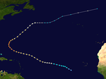
Hurricane Charlie developed in to a tropical depression from a tropical wave on August 12 approximately 1000 miles west of the Lesser Antilles. The system strengthened to tropical storm status on August 14 while moving slowly west-northwest. The storm would not significantly strengthen until moving through the Lesser Antilles early on August 15. It became a hurricane later that day, and sped up in forward speed. The storm continued west-northwest and gradually strengthened, becoming a Category 2 hurricane before making landfall in Jamaica on August 17. The hurricane emerged off the island as a Category 1 hurricane the following day. It re-stregnthened to Category 4 status before making landfall in the Yucatán Peninsula near Cozumel on August 19. The system weakened while crossing the peninsula on August 20, and emerged off the coast in the Bay of Campeche as a Category 2 storm. It held steady in course and strength on August 21 while passing over the Bay. It rapidly intensified just before landfall on August 22 near Tampico at Category 3 strength, dissipating inland on August 23.
Hurricane Charlie was the deadliest hurricane in the season, killing over 250 people and causing $575.6 million in damage (2005 USD) as it crossed through the Caribbean Sea and Gulf of Mexico.
Hurricane Dog
| Category 3 hurricane (SSHWS) | |
| Duration | August 27 – September 5 |
|---|---|
| Peak intensity | 115 mph (185 km/h) (1-min); |
Hurricane Dog developed on August 27 in the tropical Atlantic, likely from a tropical wave. It moved westward without strengthening until the 31st, when it became Tropical Storm Dog. As it crossed the central Lesser Antilles on September 2, it rapidly intensified to a 115 mph major hurricane, but unfavorable conditions weakened it steadily through the Caribbean. Dog dissipated on the 5th, after causing $3,000,000 in damage (1950 dollars) and seven casualties.
Hurricane Easy
| Category 5 hurricane (SSHWS) | |
| Duration | September 2 – September 13 |
|---|---|
| Peak intensity | 160 mph (260 km/h) (1-min); 957 mbar (hPa) |
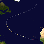
Tropical Storm Easy formed in the Tropical Atlantic on September 2, likely from a tropical wave. Easy moved generally west-northward, steadily strengthening on the way to a 160 mph Category 5 hurricane on the 7th. It turned to the northeast, where cooler waters and upper level shear steadily weakened it until it became extratropical on the 12th.
Hurricane Fox
| Category 3 hurricane (SSHWS) | |
| Duration | September 2 – September 11 |
|---|---|
| Peak intensity | 115 mph (185 km/h) (1-min); |
Several hundred miles east of Tropical Storm Easy formed on the 2nd, another storm was forming. The tropical depression moved westward, becoming a tropical storm on the 4th. Like Easy, it moved to the west-northwest, steadily strengthening to a 115 Category 3 hurricane on the 7th. It turned to the northeast, where it steadily weakened until it became extratropical on the 10th.
Tropical Storm George
| Tropical storm (SSHWS) | |
| Duration | September 20 – September 21 |
|---|---|
| Peak intensity | 60 mph (95 km/h) (1-min); |
A minimal tropical storm developed in the Bay of Campeche on September 20. George moved west-northwestward, making landfall in Mexico near Tampico, Tamaulipas, on the 21st as a 60 mph tropical storm. The storm dissipated that day.
Hurricane How
| Category 2 hurricane (SSHWS) | |
| Duration | September 28 – October 7 |
|---|---|
| Peak intensity | 110 mph (175 km/h) (1-min); |
The precursor to Hurricane How was a tropical wave that became a tropical depression in the northwestern Caribbean Sea on September 28. It moved northward through the Gulf of Mexico, strengthening to a tropical storm as it turned eastward. How hit the west coast of the U.S. state of Florida on October 2, and became a hurricane the next day. Moving northeastward, it came close to hitting the Outer Banks as a 110 mph hurricane, but it remained offshore and weakened. How became extratropical on the 7th, after causing $2,000,000 in damage (1951 dollars).
Hurricane Item
| Category 1 hurricane (SSHWS) | |
| Duration | October 12 – October 17 |
|---|---|
| Peak intensity | 80 mph (130 km/h) (1-min); |
Hurricane Item developed in the Caribbean Sea on October 12. It moved northwestward, reaching a peak of 80 mph as it drifted south of Cuba. It turned to the west, and dissipated on the 17th without causing any damage.
Hurricane Jig
| Category 1 hurricane (SSHWS) | |
| Duration | October 15 – October 20 |
|---|---|
| Peak intensity | 80 mph (130 km/h) (1-min); |
Hurricane Jig rapidly developed on October 15 over the western Atlantic, reaching hurricane strength later that day. It weakened prior to looping to the southeast, where unfavorable conditions caused it to dissipate on the 20th.
Storm names
These names were used to name storms during the 1951 Atlantic hurricane season. As this season had the same names and was less active than 1950, none of these names were used for the first time. Names that were not assigned are marked in gray.
|
|
|
See also
References
- ^ INS. Florida Relaxes, Slim Chance Of Hurricane Blowing In. Retrieved on 2008-06-06.
- ^ Associated Press. HURRICANE SEASON ENDS. Retrieved on 2008-06-06.


