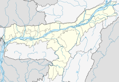
Jorhat Town railway station
Appearance
| Indian Railways station | |||||
| General information | |||||
| Location | Jorhat, Assam India | ||||
| Coordinates | 26°45′02″N 94°13′02″E / 26.7505°N 94.2171°E | ||||
| Elevation | 94 metres (308 ft) | ||||
| Owned by | Indian Railways | ||||
| Line(s) | Furkating–Mariani branch line via Jorhat | ||||
| Platforms | 2 | ||||
| Tracks | 3 | ||||
| Connections | Auto stand | ||||
| Construction | |||||
| Structure type | Standard (on-ground station) | ||||
| Parking | Yes | ||||
| Bicycle facilities | Yes | ||||
| Accessible | No | ||||
| Other information | |||||
| Status | Single diesel line | ||||
| Station code | JTTN | ||||
| Zone(s) | Northeast Frontier Railway zone | ||||
| Division(s) | Tinsukia | ||||
| History | |||||
| Electrified | No | ||||
| |||||
Jorhat Town railway station is a railway station in Jorhat district, Assam. Its code is JTTN and it serves Jorhat City. Jorhat is the secondnd developed city of Assam and Jorhat City has the biggest urban area after Guwahati. Jorhat Town Railway station consists of two platforms. Mariani Junction (MXN), the biggest railway junction of the district which is 16 km away from Jorhat City. Although Mariani is a part of Jorhat but its outskirts of Jorhat City.
The station lies on the Furkating–Mariani branch line via Jorhat and it is part of Tinsukia railway division of Northeast Frontier Railway zone.[1][2]
Trains
- Jorhat Town–Tinsukia Passenger
- Guwahati–Mariani Intercity Express
- Guwahati–Dibrugarh Intercity Express
- Dimapur–Mariani Passenger
- Guwahati–Jorhat Town Jan Shatabdi Express
References


