Sahdheer
This article needs additional citations for verification. (January 2021) |
Saaxdheer
Sahdheer | |
|---|---|
Town | |
 | |
| Coordinates: 8°0′10.63″N 47°6′26.24″E / 8.0029528°N 47.1072889°E | |
| Country | |
| Region | Sool |
| District | Kalabaydh District |
| Time zone | UTC+3 (EAT) |
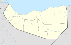
Sahdheer or Saaxdheer (Somali: Saaxdheer) is a town in the south of the Sool region of Somaliland.
Overview
Saaxdheer is on the border with Ethiopia. The town lies in the Sahader Valley, due south of Las Anod. Sahdheer lies a few miles northwest of Gumburka Cagaare,[1] the site of the greatest Darwiish victory over a joint Abyssinian-British force. The British force consisted of men from nine different regions of the world:
Within the encampment there was a strange medley of men drawn from many different corners of the Empire: From the British Isles, from South Africa, from Frontier of India, from Kenya, from the Nile, from the uplands of Central Africa, Boers and Sikhs and Sudanese: Their race had battled against the Empire not so many years before, but had since found contentment and prosperity under British rule.[2]
References
- ^ https://www.geographic.org/geographic_names/name.php?uni=-4573387&fid=5779&c=somalia
- ^ Mad Mullah of Somaliland, page 94, Douglas Jardine

