Garafad
Appearance
Garafad
| |
|---|---|
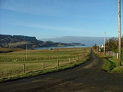
 Looking through Garafad towards Staffin Bay | |
Location within the Isle of Skye | |
| OS grid reference | NG501673 |
| Council area | |
| Country | Scotland |
| Sovereign state | United Kingdom |
| Post town | Staffin |
| Postcode district | IV51 9 |
| Police | Scotland |
| Fire | Scottish |
| Ambulance | Scottish |
Garafad or Garafad, (Template:Lang-gd) is a linear crofting settlement on the east coast of the Trotternish Peninsula of Skye in the Scottish Highlands and is in the Scottish council area of Highland.[1]
It is part of Staffin, and lies 14 miles (23 kilometres) north of Portree.
References
External links
![]() Media related to Garafad at Wikimedia Commons
Media related to Garafad at Wikimedia Commons

