Ouragahio
Appearance
Ouragahio | |
|---|---|
Town, sub-prefecture, and commune | |
| Coordinates: 6°27′N 5°52′W / 6.450°N 5.867°W | |
| Country | |
| District | Gôh-Djiboua |
| Region | Gôh |
| Department | Gagnoa |
| Population (2014)[1] | |
| • Total | 36,364 |
| Time zone | UTC+0 (GMT) |
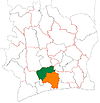
Ouragahio is a town in south-central Ivory Coast. It is a sub-prefecture and commune of Gagnoa Department in Gôh Region, Gôh-Djiboua District.
Ivory Coast international footballers Serge Aurier and Franck Kessié were born in Ouragahio.
In 2014, the population of the sub-prefecture of Ouragahio was 36,364.[2]
Villages
- Bodocipa (896)
- Broudoumé (2 005)
- Gnaliépa (1 014)
- Karahi (369)
- Kpapékou (3 086)
- Krogbopa (1 564)
- Mama (2 208)
- Oundjibipa (1 032)
- Ouragahio (11 253)
- Siégouékou (1 802)
- Zébizékou (1 118)
- Drayo-Dagnoa (4 841)
- Izambré (2 242)
- Kokouezo (908)
- Nazia (809)
- Tiépa (1 217)
References
- ^ "Côte d'Ivoire". geohive.com. Retrieved 8 December 2015.
- ^ "RGPH 2014, Répertoire des localités, Région Gôh" (PDF). ins.ci. Retrieved 5 August 2019.[permanent dead link]


