Ray, Alabama
Appearance
Ray, Alabama | |
|---|---|
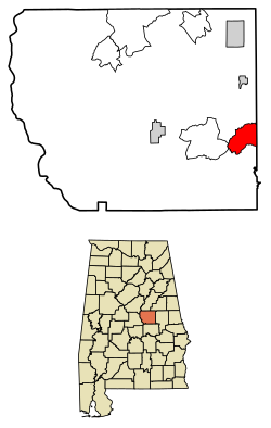
 Location of Ray in Coosa County, Alabama. | |
| Coordinates: 32°53′14″N 86°02′16″W / 32.88722°N 86.03778°W | |
| Country | United States |
| State | Alabama |
| County | Coosa |
| Area | |
• Total | 8.25 sq mi (21.36 km2) |
| • Land | 8.20 sq mi (21.25 km2) |
| • Water | 0.04 sq mi (0.12 km2) |
| Elevation | 732 ft (223 m) |
| Population | |
• Total | 409 |
• Estimate (2016)[3] | N/A |
| Time zone | UTC-6 (Central (CST)) |
| • Summer (DST) | UTC-5 (CDT) |
| Area code(s) | 256 & 938 |
| GNIS feature ID | 125452[4] |
Ray is a census-designated place and unincorporated community in Coosa County, Alabama, United States. Its population was 443 as of the 2010 census.[5]
Demographics
| Census | Pop. | Note | %± |
|---|---|---|---|
| U.S. Decennial Census[6] | |||
References
- ^ "2016 U.S. Gazetteer Files". United States Census Bureau. Retrieved Jul 17, 2017.
- ^ "U.S. Census website". United States Census Bureau. Retrieved 2011-05-14.
- ^ "Population and Housing Unit Estimates". Retrieved June 9, 2017.
- ^ "Ray". Geographic Names Information System. United States Geological Survey, United States Department of the Interior.
- ^ "Geographic Identifiers: 2010 Demographic Profile Data (G001): Ray CDP, Alabama". U.S. Census Bureau, American Factfinder. Archived from the original on February 12, 2020. Retrieved June 9, 2014.
- ^ "Census of Population and Housing". Census.gov. Retrieved June 4, 2016.


