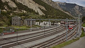
Sembrancher railway station
Appearance
Sembrancher | |||||
|---|---|---|---|---|---|
 The station in 2017 | |||||
| General information | |||||
| Location | Sembrancher Switzerland | ||||
| Coordinates | 46°4′36.847″N 7°8′44.707″E / 46.07690194°N 7.14575194°E | ||||
| Elevation | 717 m (2,352 ft) | ||||
| Owned by | Transports de Martigny et Régions | ||||
| Line(s) | Martigny–Orsières line | ||||
| Distance | 13.1 km (8.1 mi) from Martigny[1] | ||||
| Train operators | RegionAlps | ||||
| Connections | CarPostal Suisse bus lines[2] | ||||
| Services | |||||
|
Lua error in Module:Adjacent_stations at line 237: Unknown line "Regio". | |||||
| |||||
Sembrancher railway station (French: Gare de Sembrancher) is a railway station in the municipality of Sembrancher, in the Swiss canton of Valais. It is located on the standard gauge Martigny–Orsières line of Transports de Martigny et Régions, at the point where the line splits, with branches going to Le Châble and Orsières.[1]
Services
As of the December 2020 timetable change,[update] the following services stop at Sembrancher:[3]
References
- ^ a b Eisenbahnatlas Schweiz. Cologne: Schweers + Wall. 2012. p. 55. ISBN 978-3-89494-130-7.
- ^ "Réseau de lignes: Martigny" (PDF) (in French). PostBus Switzerland. 13 December 2020. Retrieved 1 February 2021.
- ^ "Martigny - Sembrancher - Le Châble - (Verbier)" (PDF). Bundesamt für Verkehr. 22 October 2020. Retrieved 1 February 2021.
External links
 Media related to Sembrancher railway station at Wikimedia Commons
- Sembrancher railway station – RegionAlps (in French)

